|
search place name
|
||
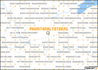
Phumĭ Thnál Tôtœ̆ng (Bântéay Méan Cheăy, Cambodia)Phumĭ Thnál Tôtœ̆ng is a town in the Bântéay Méan Cheăy region of Cambodia. An overview map of the region around Phumĭ Thnál Tôtœ̆ng is displayed below.
regional and 3d topo map of Phumĭ Thnál Tôtœ̆ng, Cambodia ::
Phumĭ Thnál Tôtœ̆ng airports ::
The nearest airport is PNH - Phnom-penh Phnom Penh Intl, located 20.0 km east of Phumĭ Thnál Tôtœ̆ng.
Other airports nearby include SGN - Ho Chi Minh City Tansonnhat Intl (229.6 km east), REP - Siem-reap Siem Reap (230.9 km north west), Nearby towns ::
Phumĭ Pông Tœ̆k (1.8km east) //
Phumĭ Tônloăb Khpós (1.8km east) //
Phumĭ Prey Châmkar (1.9km south) //
Phumĭ Prey Tôtœ̆ng (1) (2.6km south east) //
Phumĭ Káb Chhkê (2.6km south east) //
Phumĭ Dâmnăk Âmpĭl (2.6km north east) //
Phumĭ Ângk Khmau (2.6km north west) //
Phumĭ Trâpeăng Rœssei (2.6km north west) //
Phumĭ Thlôk Yól (2.6km north west) //
Phumĭ Tarôdth (3.7km south) //
Phumĭ Trâpeăng Chrâniĕng (3.6km east) //
Phumĭ Prâmôr Tachey (3.6km east) //
Phumĭ Trâpeăng Trach (4.1km north east) //
Khŭm Lumhach (4.1km south east) //
Phumĭ Chheutéal Kraôm (4.1km south west) //
Phumĭ Trâyœ̆ng (4.1km north east) //
Phumĭ Thlaeuk (4.1km north east) //
Phumĭ Krăng Léav (4.1km south east) //
Phumĭ Prâmôr (4.1km south east) //
Phumĭ Kândaôs (5.2km south east) //
Khŭm Trâpeăng Kông (5.2km south west) //
Phumĭ Kâmpóng Trăm (5.6km south) //
Phumĭ Thmei (2) (5.6km south) //
Ângk Snuŏl (5.4km east) //
Phumĭ Srê Omprŭm (5.8km north) //
Phumĭ Koŭk Pôpél (5.8km south) //
Phumĭ Tapéng (5.8km south) //
Phumĭ Trâpeăng Thmâ (5.8km north) //
Phumĭ Krăng Léav (5.8km north) //
[all distances 'as the bird flies' and approximate]  Places with similar names to Phumĭ Thnál Tôtœ̆ng, Cambodia ::
// Phumĭ Thnál Tôtœ̆ng (KH)
// Phumĭ Thnál Tôtœ̆ng (KH)
Disclaimer :: Information on this page comes without warranty of any kind |
||
|
Where is Phumĭ Thnál Tôtœ̆ng? Elevation and coordinates ::
Latitude (lat): 11°30'0"N Longitude (lon): 104°40'0"E
Elevation (approx.): 26m (map arrows pan, magnifying glasses zoom) |
||
|
Visiting Phumĭ Thnál Tôtœ̆ng? Hotel/Accommodation ::
Book a hotel in Phumĭ Thnál Tôtœ̆ng Travel Guide ::
Buy a travel guide for Cambodia rental cars ::
car rental offers GPS waypoint ::
download a GPX waypoint (PoI) of Phumĭ Thnál Tôtœ̆ng for your GPS receiver
|
||