|
search place name
|
||
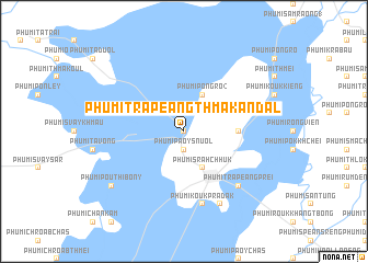
Phumĭ Trâpeăng Thmâ Kândal (Siĕm Réab, Cambodia)Phumĭ Trâpeăng Thmâ Kândal is a town in the Siĕm Réab region of Cambodia. An overview map of the region around Phumĭ Trâpeăng Thmâ Kândal is displayed below.
regional and 3d topo map of Phumĭ Trâpeăng Thmâ Kândal, Cambodia ::
Phumĭ Trâpeăng Thmâ Kândal airports ::
The nearest airport is REP - Siem-reap Siem Reap, located 67.7 km south east of Phumĭ Trâpeăng Thmâ Kândal.
Other airports nearby include NAK - Nakhon Ratchasima Khorat (184.5 km north west), Nearby towns ::
Phumĭ Ta Ŏng (NaNkm north) //
Phumĭ Paôy Snuŏl (1.9km south) //
Phumĭ Sâmbuŏr (2.6km north east) //
Phumĭ Srăh Chhuk (4.1km south east) //
Phumĭ Pôngrô (2) (4.1km north east) //
Phumĭ Kâmpring Puŏy (5.4km east) //
Phumĭ Koŭk Prâdak (7.6km south) //
Phumĭ Kaôh Trék (7.6km south) //
Phumĭ Pônley (7.4km east) //
Phumĭ Saliĕng (7.4km east) //
Phumĭ Trâpeăng Prei (7.8km south east) //
Phumĭ Bŏs Sbov (8.2km south east) //
Phumĭ Poŭthĭ Bŏny (9.1km south west) //
[all distances 'as the bird flies' and approximate]  Places with similar names to Phumĭ Trâpeăng Thmâ Kândal, Cambodia :: Disclaimer :: Information on this page comes without warranty of any kind |
||
|
Where is Phumĭ Trâpeăng Thmâ Kândal? Elevation and coordinates ::
Latitude (lat): 13°47'0"N Longitude (lon): 103°19'0"E
Elevation (approx.): 23m (map arrows pan, magnifying glasses zoom) |
||
|
Visiting Phumĭ Trâpeăng Thmâ Kândal? Hotel/Accommodation ::
Book a hotel in Phumĭ Trâpeăng Thmâ Kândal Travel Guide ::
Buy a travel guide for Cambodia rental cars ::
car rental offers GPS waypoint ::
download a GPX waypoint (PoI) of Phumĭ Trâpeăng Thmâ Kândal for your GPS receiver
|
||