|
search place name
|
||
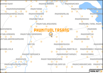
Phumĭ Tuŏl Ta Sáng (Bătdâmbâng, Cambodia)Phumĭ Tuŏl Ta Sáng is a town in the Bătdâmbâng region of Cambodia. An overview map of the region around Phumĭ Tuŏl Ta Sáng is displayed below.
regional and 3d topo map of Phumĭ Tuŏl Ta Sáng, Cambodia ::
Phumĭ Tuŏl Ta Sáng airports ::
The nearest airport is REP - Siem-reap Siem Reap, located 82.3 km north east of Phumĭ Tuŏl Ta Sáng.
Other airports nearby include PNH - Phnom-penh Phnom Penh Intl (235.5 km south east), NAK - Nakhon Ratchasima Khorat (251.7 km north west), Nearby towns ::
Phumĭ Prey Tôtœ̆ng (0.0km north) //
Phumĭ Prey Svay (1.8km east) //
Phumĭ Tuŏl Thmei (1) (2.6km north east) //
Phumĭ Sdei (2.6km south east) //
Phumĭ Svay Chéatĕ (4.1km south east) //
Phumĭ Rœssei Prey (4.1km north east) //
Phumĭ Tuŏl Ângkrông (4.1km north west) //
Phumĭ Tuŏl Bay Dâmrăm (4.1km north west) //
Phumĭ Tuŏl Trăm Trâsák (4.1km south west) //
Phumĭ Bœ̆ng Kei (1) (5.2km south east) //
Phumĭ Véal Khang Tbong (5.6km south) //
Phumĭ Tuŏl Chăntôy (5.8km south) //
Reăng Kései (5.7km east) //
Phumĭ Bay Dâmrăm (6.6km north west) //
Phumĭ Châmkar Svay (7.2km west) //
Phumĭ Dong (7.2km west) //
Phumĭ Kâmpâng (7.2km west) //
Phumĭ Tuŏl Chrânéang (7.2km west) //
Phumĭ Banăn (7.2km west) //
Phumĭ Kâmpóng Koŭ (7.5km east) //
Phumĭ Kânhchraông (7.5km west) //
Phumĭ Svay Bei Daeum (7.5km west) //
Phumĭ Chhay Rŭmpoăt (7.5km west) //
Phumĭ Koŭk Poŭn (7.8km south east) //
Phumĭ Véal Poăn Talei (7.8km south east) //
Phumĭ Bát Sala (7.8km north west) //
Phumĭ Phnum Kôy (1) (8.2km south east) //
Phumĭ O Srâlau (8.2km north east) //
Kântœ (8.1km south west) //
[all distances 'as the bird flies' and approximate] 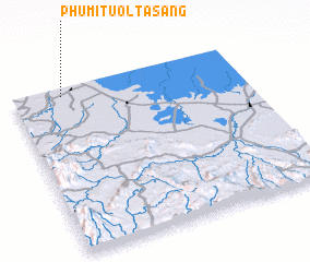 Places with similar names to Phumĭ Tuŏl Ta Sáng, Cambodia :: Disclaimer :: Information on this page comes without warranty of any kind |
||
|
Where is Phumĭ Tuŏl Ta Sáng? Elevation and coordinates ::
Latitude (lat): 12°57'0"N Longitude (lon): 103°13'0"E
Elevation (approx.): 24m (map arrows pan, magnifying glasses zoom) |
||
|
Visiting Phumĭ Tuŏl Ta Sáng? Hotel/Accommodation ::
Book a hotel in Phumĭ Tuŏl Ta Sáng Travel Guide ::
Buy a travel guide for Cambodia rental cars ::
car rental offers GPS waypoint ::
download a GPX waypoint (PoI) of Phumĭ Tuŏl Ta Sáng for your GPS receiver
|
||