|
search place name
|
||
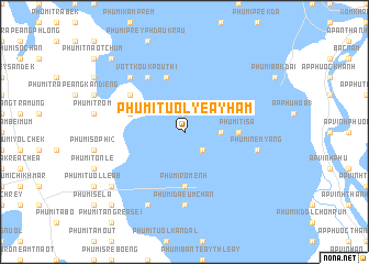
Phumĭ Tuŏl Yéay Hâm (Takêv, Cambodia)Phumĭ Tuŏl Yéay Hâm is a town in the Takêv region of Cambodia. An overview map of the region around Phumĭ Tuŏl Yéay Hâm is displayed below.
regional and 3d topo map of Phumĭ Tuŏl Yéay Hâm, Cambodia ::
Phumĭ Tuŏl Yéay Hâm airports ::
The nearest airport is PNH - Phnom-penh Phnom Penh Intl, located 77.9 km north of Phumĭ Tuŏl Yéay Hâm.
Other airports nearby include SGN - Ho Chi Minh City Tansonnhat Intl (186.1 km east), Nearby towns ::
Phumĭ Kâmpóng Âmpĭl (1.9km north) //
Phumĭ Khnăch Duŏch (2.6km south east) //
Phumĭ Ânlóng Tiĕn (3.6km east) //
Phumĭ Tisa (5.5km east) //
Phumĭ Rôménh (5.6km south) //
Phumĭ Kândaôl (5.8km west) //
Phumĭ Kâmpóng Yoŭl (5.9km north) //
Phumĭ Koŭk Poŭthĭ (6.6km north west) //
Vôtt Koŭk Poŭthĭ (6.6km north west) //
Phumĭ Daeum Chăn (7.4km south) //
Phumĭ Nêm Yang (7.5km east) //
Phumĭ Prey Mul (7.8km north west) //
Phumĭ Bœ̆ng Cham (8.3km south west) //
Phumĭ Rôluŏs (9.2km south west) //
Phumĭ Sâmraông (1) (9.2km south west) //
Phumĭ Ândong Sâmrĕt (10.4km south west) //
Phumĭ Svay (10.4km north west) //
[all distances 'as the bird flies' and approximate]  Places with similar names to Phumĭ Tuŏl Yéay Hâm, Cambodia :: Disclaimer :: Information on this page comes without warranty of any kind |
||
|
Where is Phumĭ Tuŏl Yéay Hâm? Elevation and coordinates ::
Latitude (lat): 10°51'0"N Longitude (lon): 104°57'0"E
Elevation (approx.): 1m (map arrows pan, magnifying glasses zoom) |
||
|
Visiting Phumĭ Tuŏl Yéay Hâm? Hotel/Accommodation ::
Book a hotel in Phumĭ Tuŏl Yéay Hâm Travel Guide ::
Buy a travel guide for Cambodia rental cars ::
car rental offers GPS waypoint ::
download a GPX waypoint (PoI) of Phumĭ Tuŏl Yéay Hâm for your GPS receiver
|
||