|
search place name
|
||
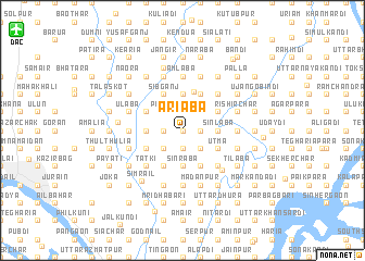
Ariāba (Barisāl, Bangladesh)Ariāba is a town in the Barisāl region of Bangladesh. An overview map of the region around Ariāba is displayed below.
regional and 3d topo map of Ariāba, Bangladesh ::
Ariāba airports ::
The nearest airport is DAC - Dhaka Zia Intl, located 18.6 km north west of Ariāba.
Other airports nearby include IXA - Agartala (72.0 km east), JSR - Jessore (155.2 km south west), IRD - Ishurdi (159.1 km west), IXH - Kailashahar (160.6 km north east), Nearby towns ::
Tetlāba (0.0km north) //
Māsāba (0.0km north) //
Sutālara (1.9km south) //
Mirkuti (1.9km north) //
Mirkuti Chhao (1.9km north) //
Karnagop (1.7km west) //
Debai (1.7km west) //
Noāgaon (1.7km west) //
Airāba (1.7km east) //
Barpa (1.7km west) //
Perāba (1.7km east) //
Uttar Rupsi (2.5km south west) //
Golakāndail (2.5km north east) //
Bhārgaon (2.5km south west) //
Khādan (2.5km south west) //
Baragaon (2.5km south east) //
Sādipur (2.5km south east) //
Maukuli (2.5km south west) //
Nārsingal (2.5km north west) //
Pārāin (2.5km north west) //
Brāhmangaon (2.5km north west) //
Bharat (2.5km south east) //
Dāsnaogaon (2.5km south east) //
Char Gandharbapur (3.4km west) //
Sinrāba (3.7km south) //
Pānchāikhān (3.7km north) //
Bhāela (3.7km north) //
Murāpara (3.7km north) //
Sairpa (3.7km south) //
[all distances 'as the bird flies' and approximate]  Places with similar names to Ariāba, Bangladesh ::
Disclaimer :: Information on this page comes without warranty of any kind |
||
|
Where is Ariāba? Elevation and coordinates ::
Latitude (lat): 23°45'0"N Longitude (lon): 90°33'0"E
Elevation (approx.): 6m (map arrows pan, magnifying glasses zoom) |
||
|
Visiting Ariāba? Hotel/Accommodation ::
Book a hotel in Ariāba Travel Guide ::
Buy a travel guide for Bangladesh rental cars ::
car rental offers GPS waypoint ::
download a GPX waypoint (PoI) of Ariāba for your GPS receiver
|
||