|
search place name
|
||
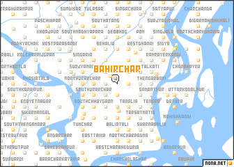
Bāhir Char (Barisāl, Bangladesh)Bāhir Char is a town in the Barisāl region of Bangladesh. An overview map of the region around Bāhir Char is displayed below.
regional and 3d topo map of Bāhir Char, Bangladesh ::
Bāhir Char airports ::
The nearest airport is DAC - Dhaka Zia Intl, located 80.5 km north of Bāhir Char.
Other airports nearby include IXA - Agartala (122.2 km north east), JSR - Jessore (125.4 km west), CGP - Chittagong Shah Amanat Intl (175.5 km south east), IRD - Ishurdi (178.0 km north west), Nearby towns ::
Snānghāta (1.6km north west) //
Dāsmantāra (1.7km west) //
Rānisār (1.9km south) //
Bālikuri (1.9km south) //
Char Pātālia (1.9km south) //
Ādāsan (1.7km east) //
Māmudpatti (1.7km east) //
Mālgaon (2.5km north west) //
Purbakāndi (2.5km north west) //
Char Dhānakāti (2.5km north east) //
Char Chhātiāni (2.5km north east) //
Paithkati (2.5km north east) //
Tumchar (2.5km south west) //
Shiber Char (2.5km south west) //
North Ākālbārish (3.4km west) //
Hānifār Char (3.4km west) //
Char Sidhalkura (3.4km east) //
Nāgerpāra (3.7km south) //
Char Lakshmi Nārāyan (4.1km north west) //
Char Mālgaon (4.1km north west) //
Tilai (4.1km north east) //
Paikāti (4.1km north east) //
Sibpur (3.9km south west) //
South Ākālbarish (3.9km south west) //
Nārikeli (3.9km south west) //
Kānargaon (3.9km south west) //
South Urārchar (3.9km south west) //
South Sutalkāti (3.9km north east) //
North Sutalkāti (3.9km north east) //
[all distances 'as the bird flies' and approximate] 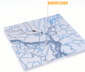 Places with similar names to Bāhir Char, Bangladesh ::
// Bāher Char (BD)
// Bāher Char (BD)
// Bāher Char (BD)
// Bāher Char (BD)
// Bāher Char (BD)
// Bāher Char (BD)
// Bāher Char (BD)
// Bāher Char (BD)
// Bāher Char (BD)
// Bāher Char (BD)
Disclaimer :: Information on this page comes without warranty of any kind |
||
|
Where is Bāhir Char? Elevation and coordinates ::
Latitude (lat): 23°7'0"N Longitude (lon): 90°23'0"E
Elevation (approx.): 4m (map arrows pan, magnifying glasses zoom) |
||
|
Visiting Bāhir Char? Hotel/Accommodation ::
Book a hotel in Bāhir Char Travel Guide ::
Buy a travel guide for Bangladesh rental cars ::
car rental offers GPS waypoint ::
download a GPX waypoint (PoI) of Bāhir Char for your GPS receiver
|
||