|
search place name
|
||
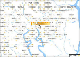
Bailāhārāni (Barisāl, Bangladesh)Bailāhārāni is a town in the Barisāl region of Bangladesh. An overview map of the region around Bailāhārāni is displayed below.
regional and 3d topo map of Bailāhārāni, Bangladesh ::
Bailāhārāni airports ::
The nearest airport is JSR - Jessore, located 85.6 km north of Bailāhārāni.
Other airports nearby include CCU - Calcutta Netaji Subhash Chandra Bose Intl (88.4 km west), IRD - Ishurdi (193.5 km north), DAC - Dhaka Zia Intl (195.9 km north east), IXA - Agartala (259.6 km north east), Nearby towns ::
Hogla (0.0km north) //
Srīfaltala (0.0km north) //
Kalāpota (1.7km east) //
Fakirpota (1.9km north) //
Joypur (1.9km south) //
Seora (1.7km west) //
Dakhin Eksara (1.7km west) //
Ghugrākāti (2.5km north east) //
Dakhin Deāra (2.5km south east) //
Lālua (2.5km north west) //
Nāngla (2.5km south west) //
Gokulnagar (2.5km south west) //
Tālberia (3.4km east) //
Bāmia (3.4km east) //
Kātni (3.4km east) //
Bāgāli (3.7km north) //
Gobindapur (3.7km south) //
Ātra (3.7km south) //
Megher Āit (3.7km south) //
Eksara (3.4km west) //
Rājāpur (3.4km west) //
Islāmpur (4.1km north east) //
Sarishāmuti (3.9km north east) //
Chatkātala (3.9km north east) //
Sholahālia (4.1km north east) //
Māthābhānga (3.9km north east) //
Arjunpur (3.9km south east) //
Swaranpur (4.1km north west) //
Simuliār Āit (4.1km south east) //
[all distances 'as the bird flies' and approximate]  Places with similar names to Bailāhārāni, Bangladesh ::
// Balhorn (DE)
// Balhorn (DE)
// Blue Heron (US)
// Bāli Hārina (BD)
// Balīharan (IN)
// Ballyhearin (IE)
Disclaimer :: Information on this page comes without warranty of any kind |
||
|
Where is Bailāhārāni? Elevation and coordinates ::
Latitude (lat): 22°25'0"N Longitude (lon): 89°16'0"E
(map arrows pan, magnifying glasses zoom) |
||
|
Visiting Bailāhārāni? Hotel/Accommodation ::
Book a hotel in Bailāhārāni Travel Guide ::
Buy a travel guide for Bangladesh rental cars ::
car rental offers GPS waypoint ::
download a GPX waypoint (PoI) of Bailāhārāni for your GPS receiver
|
||