|
search place name
|
||
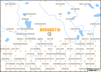
Bara Bātia (Barisāl, Bangladesh)Bara Bātia is a town in the Barisāl region of Bangladesh. An overview map of the region around Bara Bātia is displayed below.
regional and 3d topo map of Bara Bātia, Bangladesh ::
Bara Bātia airports ::
The nearest airport is ZYL - Sylhet Osmani Osmany Intl, located 117.9 km east of Bara Bātia.
Other airports nearby include DAC - Dhaka Zia Intl (133.5 km south), IXA - Agartala (136.6 km south east), IXH - Kailashahar (153.8 km south east), COH - Cooch-behar Cooch Behar (191.1 km north west), Nearby towns ::
Rātra (1.9km south) //
Bhāurtala Nagua (2.5km south west) //
Jāmdhala (3.7km south) //
Dhala Mulgaon (3.7km south) //
Bākaljhora (3.8km north east) //
Karnakhala (3.8km south east) //
Dhāmrihāla (3.8km south east) //
Haridāspur (3.8km south east) //
Jāria (3.8km south west) //
Gandāber (3.8km south west) //
Deodukān (4.1km south west) //
Pāchh Mārkenda (4.1km south west) //
Masua (4.1km south east) //
Kāfairgara (5.0km north west) //
Chheopur (5.0km south east) //
Chorerbhita (5.0km south west) //
Upla (5.6km south) //
Fādulia (5.6km south) //
Duāni Dudhkura (5.4km east) //
Bāje Dudhkura (5.4km east) //
Āg Mārkenda (5.8km south) //
Galuha (6.5km south east) //
Sāldigha (6.5km south west) //
Sālthi Ghāgrāpāra (6.5km south west) //
Bhabānipur (6.5km south west) //
Debkānda (6.5km south west) //
Chāndpur Chāndpukhuria (6.5km south west) //
Kāliāra (6.3km south east) //
Rājāpur (6.3km south east) //
[all distances 'as the bird flies' and approximate]  Places with similar names to Bara Bātia, Bangladesh ::
Disclaimer :: Information on this page comes without warranty of any kind |
||
|
Where is Bara Bātia? Elevation and coordinates ::
Latitude (lat): 25°1'0"N Longitude (lon): 90°42'0"E
Elevation (approx.): 16m (map arrows pan, magnifying glasses zoom) |
||
|
Visiting Bara Bātia? Hotel/Accommodation ::
Book a hotel in Bara Bātia Travel Guide ::
Buy a travel guide for Bangladesh rental cars ::
car rental offers GPS waypoint ::
download a GPX waypoint (PoI) of Bara Bātia for your GPS receiver
|
||