|
search place name
|
||
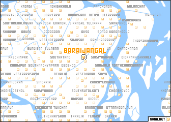
Bāraijangal (Barisāl, Bangladesh)Bāraijangal is a town in the Barisāl region of Bangladesh. An overview map of the region around Bāraijangal is displayed below.
regional and 3d topo map of Bāraijangal, Bangladesh ::
Bāraijangal airports ::
The nearest airport is DAC - Dhaka Zia Intl, located 71.3 km north of Bāraijangal.
Other airports nearby include IXA - Agartala (113.4 km north east), JSR - Jessore (128.6 km west), IRD - Ishurdi (174.9 km north west), CGP - Chittagong Shah Amanat Intl (177.9 km south east), Nearby towns ::
Lākārta (0.0km north) //
Chhatramuria (1.7km west) //
Dāmgāria (1.7km west) //
Raghurbāg (1.7km west) //
Pom (1.9km south) //
Ārāzi Pom (1.9km south) //
Āijhāra (1.9km south) //
Bara Chhaygaon (1.9km south) //
Pom Mīrzāpur (1.9km south) //
Kājalkot (1.9km north) //
Gāngsār (1.9km north) //
Demargaon (1.9km north) //
Digambarpatti (1.9km north) //
Kānchanpāra (2.2km north) //
Chandālkāndi (2.5km south east) //
Sājanpur (2.5km south east) //
Kāichkuri (2.5km south east) //
Putijuri (2.5km south east) //
Nilgun (2.5km north east) //
Mahisār (2.5km north east) //
Pāprāil (2.5km south west) //
Chandankar (2.5km south west) //
Singāchura (2.5km north west) //
Bijhāri (2.5km north west) //
Kāndigaon (2.5km north west) //
Kāpāspāra (2.5km north west) //
Tārāsimulia (3.7km south) //
Āterpāra (3.7km south) //
Nāngla (3.7km south) //
[all distances 'as the bird flies' and approximate]  Places with similar names to Bāraijangal, Bangladesh ::
Disclaimer :: Information on this page comes without warranty of any kind |
||
|
Where is Bāraijangal? Elevation and coordinates ::
Latitude (lat): 23°12'0"N Longitude (lon): 90°25'0"E
Elevation (approx.): 5m (map arrows pan, magnifying glasses zoom) |
||
|
Visiting Bāraijangal? Hotel/Accommodation ::
Book a hotel in Bāraijangal Travel Guide ::
Buy a travel guide for Bangladesh rental cars ::
car rental offers GPS waypoint ::
download a GPX waypoint (PoI) of Bāraijangal for your GPS receiver
|
||