|
search place name
|
||
Bātāsu Kājaldānga (Barisāl, Bangladesh)Bātāsu Kājaldānga is a town in the Barisāl region of Bangladesh. An overview map of the region around Bātāsu Kājaldānga is displayed below.
regional and 3d topo map of Bātāsu Kājaldānga, Bangladesh ::

Bātāsu Kājaldānga airports ::
The nearest airport is SPD - Saidpur, located 82.6 km west of Bātāsu Kājaldānga.
Other airports nearby include COH - Cooch-behar Cooch Behar (82.9 km north), RJH - Rajshahi Shah Mokhdum (171.5 km south west), IRD - Ishurdi (175.6 km south west), IXB - Baghdogra Bagdogra (182.1 km north west), Nearby towns ::
Phachuka Patrakhāta (3.7km south) //
Rāniganj Dari (3.8km north west) //
Pātoāri (5.0km north west) //
Thāna (6.2km south west) //
Guzimāri (7.4km north) //
Chilmāri (7.4km south) //
Sādulla (6.9km west) //
Bailmān Diārkhāta (7.6km south) //
Madhupur (8.9km north west) //
Dhāmsreni (8.7km north west) //
Kharkharia (9.0km south west) //
[all distances 'as the bird flies' and approximate] 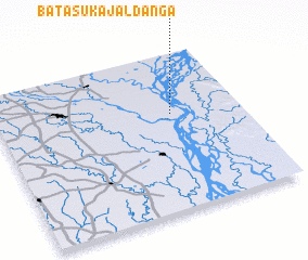 Places with similar names to Bātāsu Kājaldānga, Bangladesh :: Disclaimer :: Information on this page comes without warranty of any kind |
||
|
Where is Bātāsu Kājaldānga? Elevation and coordinates ::
Latitude (lat): 25°37'0"N Longitude (lon): 89°43'0"E
Elevation (approx.): 17m (map arrows pan, magnifying glasses zoom) |
||
|
Visiting Bātāsu Kājaldānga? Hotel/Accommodation ::
Book a hotel in Bātāsu Kājaldānga Travel Guide ::
Buy a travel guide for Bangladesh rental cars ::
car rental offers GPS waypoint ::
download a GPX waypoint (PoI) of Bātāsu Kājaldānga for your GPS receiver
|
||