|
search place name
|
||
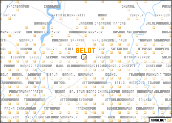
Belot (Barisāl, Bangladesh)Belot is a town in the Barisāl region of Bangladesh. An overview map of the region around Belot is displayed below.
regional and 3d topo map of Belot, Bangladesh ::
Belot airports ::
The nearest airport is RJH - Rajshahi Shah Mokhdum, located 62.0 km south of Belot.
Other airports nearby include SPD - Saidpur (88.3 km north), IRD - Ishurdi (93.2 km south), COH - Cooch-behar Cooch Behar (164.6 km north east), IXB - Baghdogra Bagdogra (196.1 km north), Nearby towns ::
Āltādighi (0.0km north) //
Kusumsahar (0.0km north) //
Kurāil (1.9km north) //
Bet Bāhati (1.9km north) //
Raghunāthpur (1.7km east) //
Dāul (1.7km east) //
Ghongra (1.7km west) //
Serpur (1.9km south) //
Sālijān (1.7km west) //
Sārāsan (1.9km south) //
Ekdāla (1.7km west) //
Ābdullāpur (1.7km west) //
Chak Raghunāthpur (1.9km south) //
Bāmanora (1.9km south) //
Kurāripāra (1.9km south) //
Nārāyanpur (2.5km north east) //
Krishnapur (2.5km north east) //
Ātura (2.5km north east) //
Jiānagar (2.5km north west) //
Deskhirshin (2.5km north west) //
Bijaypur (2.5km north west) //
Haripur (2.5km south east) //
Naikhutti (2.5km south east) //
Rahātta (2.5km south east) //
Sārta (2.5km south west) //
Tentulpukur (2.5km south west) //
Alankārpur (2.5km south west) //
Padmapukur (2.5km south west) //
Rāygaon (3.4km east) //
[all distances 'as the bird flies' and approximate] 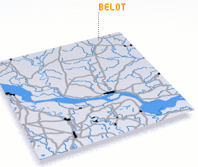 Places with similar names to Belot, Bangladesh ::
Disclaimer :: Information on this page comes without warranty of any kind |
||
|
Where is Belot? Elevation and coordinates ::
Latitude (lat): 24°58'0"N Longitude (lon): 88°49'0"E
Elevation (approx.): 21m (map arrows pan, magnifying glasses zoom) |
||
|
Visiting Belot? Hotel/Accommodation ::
Book a hotel in Belot Travel Guide ::
Buy a travel guide for Bangladesh rental cars ::
car rental offers GPS waypoint ::
download a GPX waypoint (PoI) of Belot for your GPS receiver
|
||