|
search place name
|
||
Betāgrām (Barisāl, Bangladesh)Betāgrām is a town in the Barisāl region of Bangladesh. An overview map of the region around Betāgrām is displayed below.
regional and 3d topo map of Betāgrām, Bangladesh ::

Betāgrām airports ::
The nearest airport is JSR - Jessore, located 40.3 km north of Betāgrām.
Other airports nearby include CCU - Calcutta Netaji Subhash Chandra Bose Intl (86.5 km west), IRD - Ishurdi (147.8 km north), DAC - Dhaka Zia Intl (160.9 km north east), RJH - Rajshahi Shah Mokhdum (189.6 km north), Nearby towns ::
Narania (2.5km north east) //
Chuknagar (3.4km east) //
Māgurāghona (3.9km south east) //
Bhāyra (4.1km south west) //
Bidyānandakāti (4.1km north west) //
Chākundia (5.1km east) //
Barenga (5.6km north) //
Kulbāria Barātia (6.3km south east) //
Pānjia (6.5km north east) //
Jiāla Nalta (6.5km south east) //
Bherchi (6.3km north east) //
Bhāndārkhola (6.8km west) //
Māgurādānga (7.6km north) //
Bayārsinga (7.6km south east) //
Kalāpota (8.8km south west) //
Kumira (10.1km south west) //
Ārua (10.1km north east) //
[all distances 'as the bird flies' and approximate] 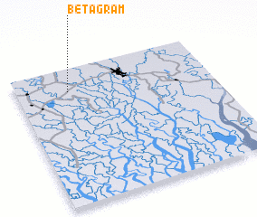 Places with similar names to Betāgrām, Bangladesh ::
// Bayt Karīm (IQ)
// Beyt-e Karīm (IR)
// Bīdgarām (IR)
// Bātāgrām (BD)
// Betgrām (BD)
// Badukrom (GH)
// Bedukrom (GH)
// Boadikrom (GH)
// Batgrām (PK)
// Batagrām (PK)
Disclaimer :: Information on this page comes without warranty of any kind |
||
|
Where is Betāgrām? Elevation and coordinates ::
Latitude (lat): 22°50'0"N Longitude (lon): 89°16'0"E
Elevation (approx.): 5m (map arrows pan, magnifying glasses zoom) |
||
|
Visiting Betāgrām? Hotel/Accommodation ::
Book a hotel in Betāgrām Travel Guide ::
Buy a travel guide for Bangladesh rental cars ::
car rental offers GPS waypoint ::
download a GPX waypoint (PoI) of Betāgrām for your GPS receiver
|
||