|
search place name
|
||
Bharpāsa (Barisāl, Bangladesh)Bharpāsa is a town in the Barisāl region of Bangladesh. An overview map of the region around Bharpāsa is displayed below.
regional and 3d topo map of Bharpāsa, Bangladesh ::

Bharpāsa airports ::
The nearest airport is JSR - Jessore, located 138.8 km north west of Bharpāsa.
Other airports nearby include DAC - Dhaka Zia Intl (145.3 km north), CGP - Chittagong Shah Amanat Intl (157.3 km east), IXA - Agartala (177.2 km north east), CCU - Calcutta Netaji Subhash Chandra Bose Intl (192.7 km west), Nearby towns ::
Rājāpur (0.0km north) //
Phalāghar (1.7km west) //
Runsi (1.9km north) //
Kānthālia (1.9km north) //
Bhabānipur (2.5km south west) //
Ārāibeki (2.5km south west) //
Rāngasri (2.5km north east) //
Syāmpur (2.5km north west) //
Terapāra (3.4km east) //
Bebāz (3.4km east) //
Krishnakāti (3.7km south) //
Nandapāra (3.7km north) //
Dāokāti (3.7km north) //
Baria (3.7km north) //
Lochanābād (3.4km west) //
Porāchina (3.4km west) //
Bihāripur (3.4km west) //
Kalaskāti (3.9km south east) //
Lakshmipāsa (3.9km south east) //
Atākāti (4.1km south east) //
Char Rāngasri (3.9km north east) //
Bākarganj (3.9km north east) //
Helencha (3.9km north east) //
Sobhākāti (4.1km north east) //
Bara Puiāutha (3.9km south west) //
Chhota Puiāutha (3.9km south west) //
Kusangal (4.1km north west) //
Kismat Seota (4.1km north west) //
Subidpur (3.9km north west) //
[all distances 'as the bird flies' and approximate] 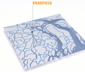 Places with similar names to Bharpāsa, Bangladesh ::
// Bharipāsa (BD)
Disclaimer :: Information on this page comes without warranty of any kind |
||
|
Where is Bharpāsa? Elevation and coordinates ::
Latitude (lat): 22°32'0"N Longitude (lon): 90°19'0"E
Elevation (approx.): 7m (map arrows pan, magnifying glasses zoom) |
||
|
Visiting Bharpāsa? Hotel/Accommodation ::
Book a hotel in Bharpāsa Travel Guide ::
Buy a travel guide for Bangladesh rental cars ::
car rental offers GPS waypoint ::
download a GPX waypoint (PoI) of Bharpāsa for your GPS receiver
|
||