|
search place name
|
||
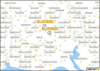
Bijaibāg (Barisāl, Bangladesh)Bijaibāg is a town in the Barisāl region of Bangladesh. An overview map of the region around Bijaibāg is displayed below.
regional and 3d topo map of Bijaibāg, Bangladesh ::
Bijaibāg airports ::
The nearest airport is CGP - Chittagong Shah Amanat Intl, located 93.9 km south east of Bijaibāg.
Other airports nearby include IXA - Agartala (107.5 km north), DAC - Dhaka Zia Intl (134.6 km north west), IXH - Kailashahar (172.4 km north east), CXB - Cox's Bazar Coxs Bazar (178.1 km south east), Nearby towns ::
Kāzirkhil (0.0km north) //
Birnārāyanpur (1.9km north) //
Rājārāmpur (1.9km north) //
Shiāmergaon (1.7km east) //
Ināyatnagar (2.5km north east) //
Kalyāndi (2.5km north west) //
Chāndīpur (2.5km south east) //
Bijāipur (2.5km south east) //
Bara Chārīgaon (2.5km south west) //
Bijaibāg (3.2km north west) //
Sharīfpur (3.4km east) //
Iākubpur (3.4km east) //
Baraia (3.4km east) //
Naldia (3.7km south) //
Birāhimpur (3.7km south) //
Nabīpur (4.0km south west) //
Bāliākāndi (3.9km north west) //
Rāmnagar (3.9km north east) //
Karmullāhpur (3.9km north east) //
Azīzfāzilpur (3.9km north east) //
Gopālpur (3.9km south west) //
Madla (3.9km south west) //
Sikandarpur (4.1km north east) //
Srīnaddi (4.1km south west) //
Srīpaddi (4.1km south west) //
Uttar Lārpur (5.0km north west) //
Debīsinhāpur (5.0km south west) //
Bara Rājāpur (5.0km south east) //
Companiganj (5.2km south east) //
[all distances 'as the bird flies' and approximate]  Places with similar names to Bijaibāg, Bangladesh ::
// Bijaibāg (BD)
Disclaimer :: Information on this page comes without warranty of any kind |
||
|
Where is Bijaibāg? Elevation and coordinates ::
Latitude (lat): 22°55'0"N Longitude (lon): 91°15'0"E
Elevation (approx.): 10m (map arrows pan, magnifying glasses zoom) |
||
|
Visiting Bijaibāg? Hotel/Accommodation ::
Book a hotel in Bijaibāg Travel Guide ::
Buy a travel guide for Bangladesh rental cars ::
car rental offers GPS waypoint ::
download a GPX waypoint (PoI) of Bijaibāg for your GPS receiver
|
||