|
search place name
|
||
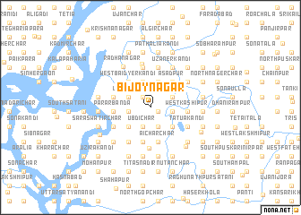
Bijoynagar (Chittagong, Bangladesh)Bijoynagar is a town in the Chittagong region of Bangladesh. An overview map of the region around Bijoynagar is displayed below.
regional and 3d topo map of Bijoynagar, Bangladesh ::
Bijoynagar airports ::
The nearest airport is DAC - Dhaka Zia Intl, located 46.8 km north west of Bijoynagar.
Other airports nearby include IXA - Agartala (51.0 km north east), IXH - Kailashahar (141.8 km north east), JSR - Jessore (176.3 km west), ZYL - Sylhet Osmani Osmany Intl (180.4 km north east), Nearby towns ::
Nilakhi (1.0km south east) //
Naya Char (1.6km north west) //
Bāhirkhola (1.6km north west) //
Madhyakāndi (2.5km north east) //
Ubdi (2.6km south) //
Ubdi Char (2.6km south) //
North Ākālia (2.6km south) //
Hābātia Char (2.6km south) //
Rājāpur (2.6km south) //
Khondakār Char (2.6km south) //
Chhoblākāndi Māthābhānga (2.6km west) //
Jaydebpur (2.6km west) //
Anantapur (2.6km east) //
North Haripur (2.9km north west) //
Ichhāpāsa (2.9km north west) //
Goālbanda (2.9km north west) //
Ghārmora (2.9km north east) //
Upār Char (2.9km north west) //
Bhāngār Char (2.9km north west) //
Kāchārikāndi (3.3km north) //
Bāghmāra (3.3km north) //
Kārārkāndi (3.3km north) //
Chhota Kālmina (3.3km north) //
North Baidyerkāndi (3.3km north) //
Mangalerkāndi (3.3km north) //
Mīr Sikāri (3.3km north) //
East Kāshipur (3.5km south east) //
Jaypur (3.5km south east) //
Jagannāthkāndi Māthābhānga (3.5km south west) //
[all distances 'as the bird flies' and approximate]  Places with similar names to Bijoynagar, Bangladesh ::
// Bajo Negro (PA)
// Bijainagar (BD)
// Bijaynagar (BD)
// Bijaynagar (BD)
// Bijaynagar (BD)
// Bijaynagar (BD)
// Bijaynagar (BD)
// Bijaynagar (BD)
// Bajo Negro (CR)
// Bijainagar (IN)
Disclaimer :: Information on this page comes without warranty of any kind |
||
|
Where is Bijoynagar? Elevation and coordinates ::
Latitude (lat): 23°39'18"N Longitude (lon): 90°48'30"E
Elevation (approx.): 9m (map arrows pan, magnifying glasses zoom) |
||
|
Visiting Bijoynagar? Hotel/Accommodation ::
Book a hotel in Bijoynagar Travel Guide ::
Buy a travel guide for Bangladesh rental cars ::
car rental offers GPS waypoint ::
download a GPX waypoint (PoI) of Bijoynagar for your GPS receiver
|
||