|
search place name
|
||
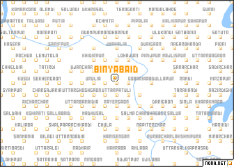
Binyābāid (Barisāl, Bangladesh)Binyābāid is a town in the Barisāl region of Bangladesh. An overview map of the region around Binyābāid is displayed below.
regional and 3d topo map of Binyābāid, Bangladesh ::
Binyābāid airports ::
The nearest airport is IXA - Agartala, located 55.5 km south east of Binyābāid.
Other airports nearby include DAC - Dhaka Zia Intl (55.6 km south west), IXH - Kailashahar (123.4 km east), ZYL - Sylhet Osmani Osmany Intl (138.3 km north east), IRD - Ishurdi (177.9 km west), Nearby towns ::
Jāmālpur (0.0km north) //
Char Krishnapur (0.0km north) //
Uttar Pātuli (1.9km south) //
Galgalia (1.9km south) //
Habispur (1.9km south) //
Brāhmanergaon (1.9km south) //
Bil Kendri (1.9km south) //
Pāikan (1.9km north) //
Purbba Charparātala (1.9km north) //
Pānchhāti (1.7km west) //
Bara Chāpa (1.7km west) //
Char Kāonia (1.7km east) //
Bhāwāler Char (1.7km east) //
Chanditala (1.7km west) //
Ātosāl (1.7km west) //
Kasba (2.5km south west) //
Uttar Bāngālgaon (2.5km south east) //
Muga (2.5km south east) //
Kālidhakona (2.5km south west) //
Krishnapur (2.5km north west) //
Bhayasān (2.5km north west) //
Urulia (3.4km west) //
Porādia (3.7km south) //
Pālertek (3.7km south) //
Gobindadi (3.7km south) //
Bāngālgaon (3.7km south) //
Rāyergaon (3.7km south) //
Char Pakshia (3.7km north) //
Gobindapur (3.9km south west) //
[all distances 'as the bird flies' and approximate] 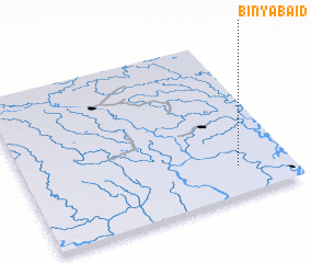 Places with similar names to Binyābāid, Bangladesh ::
Disclaimer :: Information on this page comes without warranty of any kind |
||
|
Where is Binyābāid? Elevation and coordinates ::
Latitude (lat): 24°11'0"N Longitude (lon): 90°48'0"E
Elevation (approx.): 9m (map arrows pan, magnifying glasses zoom) |
||
|
Visiting Binyābāid? Hotel/Accommodation ::
Book a hotel in Binyābāid Travel Guide ::
Buy a travel guide for Bangladesh rental cars ::
car rental offers GPS waypoint ::
download a GPX waypoint (PoI) of Binyābāid for your GPS receiver
|
||