|
search place name
|
||
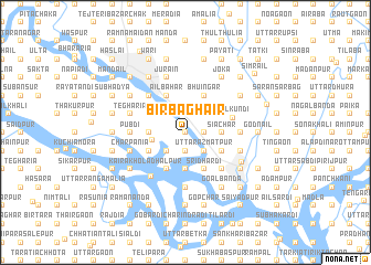
Bir Bāghair (Barisāl, Bangladesh)Bir Bāghair is a town in the Barisāl region of Bangladesh. An overview map of the region around Bir Bāghair is displayed below.
regional and 3d topo map of Bir Bāghair, Bangladesh ::
Bir Bāghair airports ::
The nearest airport is DAC - Dhaka Zia Intl, located 22.1 km north of Bir Bāghair.
Other airports nearby include IXA - Agartala (84.7 km east), JSR - Jessore (141.5 km west), IRD - Ishurdi (153.1 km west), IXH - Kailashahar (174.4 km north east), Nearby towns ::
Dhopātita (0.0km north) //
Pāngaon (0.0km north) //
Motbāri (0.0km north) //
Chandramādhab (1.9km south) //
Utrāil (1.9km south) //
Āstadona (1.9km south) //
Purba Bāghair (1.9km south) //
Char Sridhardi (1.9km south) //
Dānānagar (1.9km south) //
Brāhmangaon (1.9km south) //
Kadamtali (1.9km north) //
Hāzāribāg (1.9km north) //
Pāgla (1.9km north) //
Dāpa Idrākpur (1.7km east) //
Philkuni (1.9km north) //
Āliganj (1.7km east) //
Uttar Āzmatpur (2.5km south east) //
Dakshin Āzmatpur (2.5km south east) //
Ālinagar (2.5km south east) //
Hariharpāra (2.5km south east) //
Ghonākonda (2.5km south west) //
Jānjira (2.5km south west) //
Kātuāil (2.5km south east) //
Fazilpur (2.5km south east) //
Konda (2.5km south west) //
Doleswar (2.5km north west) //
Āinta (2.5km north west) //
Deulpāra (2.5km north east) //
Bākta (3.1km west) //
[all distances 'as the bird flies' and approximate] 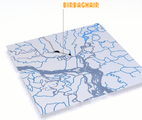 Places with similar names to Bir Bāghair, Bangladesh ::
// Birabafara (ML)
// Barbefer (FR)
Disclaimer :: Information on this page comes without warranty of any kind |
||
|
Where is Bir Bāghair? Elevation and coordinates ::
Latitude (lat): 23°39'0"N Longitude (lon): 90°27'0"E
Elevation (approx.): 7m (map arrows pan, magnifying glasses zoom) |
||
|
Visiting Bir Bāghair? Hotel/Accommodation ::
Book a hotel in Bir Bāghair Travel Guide ::
Buy a travel guide for Bangladesh rental cars ::
car rental offers GPS waypoint ::
download a GPX waypoint (PoI) of Bir Bāghair for your GPS receiver
|
||