|
search place name
|
||
Bir Pāgli (Barisāl, Bangladesh)Bir Pāgli is a town in the Barisāl region of Bangladesh. An overview map of the region around Bir Pāgli is displayed below.
regional and 3d topo map of Bir Pāgli, Bangladesh ::

Bir Pāgli airports ::
The nearest airport is ZYL - Sylhet Osmani Osmany Intl, located 98.2 km east of Bir Pāgli.
Other airports nearby include IXA - Agartala (113.9 km south), DAC - Dhaka Zia Intl (124.3 km south west), IXH - Kailashahar (128.1 km south east), IRD - Ishurdi (203.5 km south west), Nearby towns ::
Nischintapur (0.0km north) //
Bikramsri (1.9km north) //
Swalpa Kālika (1.9km north) //
Bri Kālika (1.9km north) //
Lāuphul (1.7km east) //
Gorāund (1.7km east) //
Pirijpur (1.9km south) //
Ichhāil (1.9km south) //
Phulbāria (1.9km south) //
Āmghāil (1.9km south) //
Gandharbbapur (1.7km west) //
Jasmādhab (1.7km west) //
Bara Gaon (1.7km west) //
Salpa Pāgli (1.7km west) //
Mohanpur (1.7km west) //
Bālijuri (2.5km north east) //
Bri Chāpārkona (2.5km north west) //
Guhiāla (2.5km north west) //
Jugisāsan (2.5km north west) //
Kāstala (2.5km north west) //
Nandura (2.5km north west) //
Bāraghar (2.5km north west) //
Rasulpur (2.5km north west) //
Nārāchatal (2.5km south east) //
Saidpur (2.5km south east) //
Kāchhutia (2.5km south east) //
Uttar Chāshāpāra (2.5km south west) //
Mansurpur (2.5km south west) //
Jithan (2.5km south west) //
[all distances 'as the bird flies' and approximate] 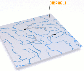 Places with similar names to Bir Pāgli, Bangladesh ::
// Bara Pāgla (BD)
Disclaimer :: Information on this page comes without warranty of any kind |
||
|
Where is Bir Pāgli? Elevation and coordinates ::
Latitude (lat): 24°52'0"N Longitude (lon): 90°54'0"E
Elevation (approx.): 9m (map arrows pan, magnifying glasses zoom) |
||
|
Visiting Bir Pāgli? Hotel/Accommodation ::
Book a hotel in Bir Pāgli Travel Guide ::
Buy a travel guide for Bangladesh rental cars ::
car rental offers GPS waypoint ::
download a GPX waypoint (PoI) of Bir Pāgli for your GPS receiver
|
||