|
search place name
|
||
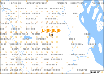
Chak Donr (Barisāl, Bangladesh)Chak Donr is a town in the Barisāl region of Bangladesh. An overview map of the region around Chak Donr is displayed below.
regional and 3d topo map of Chak Donr, Bangladesh ::
Chak Donr airports ::
The nearest airport is IRD - Ishurdi, located 95.4 km south west of Chak Donr.
Other airports nearby include RJH - Rajshahi Shah Mokhdum (102.6 km south west), SPD - Saidpur (109.8 km north west), DAC - Dhaka Zia Intl (150.8 km south east), COH - Cooch-behar Cooch Behar (156.6 km north), Nearby towns ::
Kismat Sihipur (0.0km north) //
Najarerpāra (0.0km north) //
Dongar (0.0km north) //
Prathamārcheo (1.7km west) //
Māsundi (1.9km north) //
Telihāta (1.9km north) //
Mominhāta (1.9km south) //
Pār Kākra (1.7km east) //
Rahimārpāra (1.9km south) //
Ākandapāra (1.9km south) //
Nij Kākra (1.7km east) //
Tiarpāra (2.5km north west) //
Bāhādurpur (2.5km south west) //
Sukhānpukur (2.5km north east) //
Naodābaga (2.5km north east) //
Kadamtali (2.5km south east) //
Gajāria (3.4km west) //
Uttar Bānshāta (3.7km north) //
Chānrālkāndi (3.7km north) //
Sihipur (3.7km north) //
Bāoitona (3.7km south) //
Ganiarikāndi (4.1km north west) //
Mahīcharan (4.1km north west) //
Hosainpur (3.8km north west) //
Mendipur (3.8km south west) //
Uttar Sukhānpukur (4.1km north east) //
Jaibhoga (4.1km south west) //
Dhananjoy (4.1km south east) //
Sardhankuthi (5.0km north west) //
[all distances 'as the bird flies' and approximate] 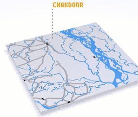 Places with similar names to Chak Donr, Bangladesh ::
// Chkidianari (GE)
Disclaimer :: Information on this page comes without warranty of any kind |
||
|
Where is Chak Donr? Elevation and coordinates ::
Latitude (lat): 24°55'0"N Longitude (lon): 89°29'0"E
Elevation (approx.): 22m (map arrows pan, magnifying glasses zoom) |
||
|
Visiting Chak Donr? Hotel/Accommodation ::
Book a hotel in Chak Donr Travel Guide ::
Buy a travel guide for Bangladesh rental cars ::
car rental offers GPS waypoint ::
download a GPX waypoint (PoI) of Chak Donr for your GPS receiver
|
||