|
search place name
|
||
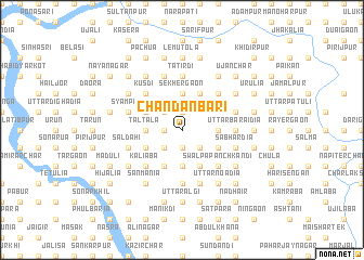
Chandanbāri (Barisāl, Bangladesh)Chandanbāri is a town in the Barisāl region of Bangladesh. An overview map of the region around Chandanbāri is displayed below.
regional and 3d topo map of Chandanbāri, Bangladesh ::
Chandanbāri airports ::
The nearest airport is DAC - Dhaka Zia Intl, located 45.8 km south west of Chandanbāri.
Other airports nearby include IXA - Agartala (62.2 km south east), IXH - Kailashahar (133.9 km east), ZYL - Sylhet Osmani Osmany Intl (148.6 km north east), IRD - Ishurdi (167.7 km west), Nearby towns ::
Char Kshirāti (1.9km south) //
Hārordia (1.9km south) //
Aichār Char (1.7km west) //
Arjun Char (1.9km north) //
Char Gajāria (1.9km north) //
Asadnagar (1.9km north) //
Ghāgatia (1.7km west) //
Kshirāti (2.5km south west) //
Char Nilākhi (2.5km south west) //
Sallābāid (2.5km south east) //
Char Bāgua (2.5km north west) //
Bāgua (2.5km north west) //
Mādhabdi Chak (3.4km east) //
Nārāndi (3.7km south) //
Gājaria (3.7km north) //
Joār Gajāria (3.7km north) //
Sekhergaon (3.7km north) //
Tāltala (3.4km west) //
Jāba (3.4km west) //
Mirzānagar (3.9km south east) //
Sukundi (4.1km south east) //
Dasdonār Chak (4.1km south east) //
Char Nārāndi (4.1km south west) //
Dighākāndi (4.1km south west) //
Nalua Chak (4.1km north east) //
Kāmārgaon (3.9km south west) //
Narottampur (3.9km north west) //
Char Durlabh Khān (3.9km north west) //
Swalpa Pānchkāndi (5.0km south east) //
[all distances 'as the bird flies' and approximate] 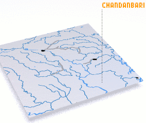 Places with similar names to Chandanbāri, Bangladesh ::
// Chandanbāri (BD)
Disclaimer :: Information on this page comes without warranty of any kind |
||
|
Where is Chandanbāri? Elevation and coordinates ::
Latitude (lat): 24°9'0"N Longitude (lon): 90°42'0"E
Elevation (approx.): 14m (map arrows pan, magnifying glasses zoom) |
||
|
Visiting Chandanbāri? Hotel/Accommodation ::
Book a hotel in Chandanbāri Travel Guide ::
Buy a travel guide for Bangladesh rental cars ::
car rental offers GPS waypoint ::
download a GPX waypoint (PoI) of Chandanbāri for your GPS receiver
|
||