|
search place name
|
||
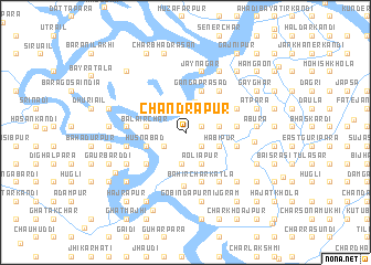
Chandrapur (Dhaka, Bangladesh)Chandrapur is a town in the Dhaka region of Bangladesh. An overview map of the region around Chandrapur is displayed below.
regional and 3d topo map of Chandrapur, Bangladesh ::
Chandrapur airports ::
The nearest airport is DAC - Dhaka Zia Intl, located 68.3 km north of Chandrapur.
Other airports nearby include JSR - Jessore (110.3 km west), IXA - Agartala (124.8 km north east), IRD - Ishurdi (157.3 km north west), CCU - Calcutta Netaji Subhash Chandra Bose Intl (194.8 km west), Nearby towns ::
Lakshmīpur (0.6km north west) //
Santoshpur (1.5km east) //
Chhilār Char (1.9km south east) //
West Raghurāmpur (2.4km south west) //
East Raghurāmpur (3.2km south) //
Rāypur (3.2km north) //
Shibpur (3.2km east) //
Āoliāpur (3.5km south east) //
Habipur (3.4km south east) //
Bāhir Chandrapur (3.4km south east) //
Chhota Binodpur (3.4km south east) //
Balāir Char (3.7km west) //
Kirttinagar (3.9km north east) //
Husnābad (3.9km west) //
Kālikāpur (3.9km west) //
Gangāprasād (4.5km north) //
Māhisher Char (4.9km south west) //
Bāhir Char Kātla (5.2km south) //
Bagādi (4.9km east) //
Paschim Kāndi (5.0km east) //
Bara Binodpur (5.0km east) //
Muhammadpur (5.0km east) //
Gāzipur (5.3km north east) //
Khorātala (5.3km north east) //
Char Jaynagar (5.3km north east) //
Char Gāzipur (5.3km north east) //
Jāfarābād (5.5km south) //
South Kebalnagar (5.4km north east) //
Char Kirttinagar (5.4km north east) //
[all distances 'as the bird flies' and approximate] 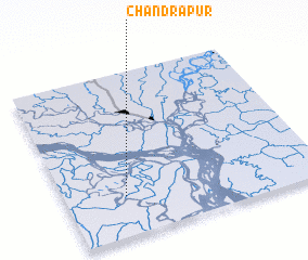 Places with similar names to Chandrapur, Bangladesh ::
// Chānderpāra (BD)
// Chandrapāra (BD)
// Chandrapur (BD)
// Chandrapur (BD)
// Chandrapur (BD)
// Chandrapur (BD)
// Chandrapur (BD)
// Chandrāpur (BD)
// Chandarpur (IN)
// Chandarpur (IN)
Disclaimer :: Information on this page comes without warranty of any kind |
||
|
Where is Chandrapur? Elevation and coordinates ::
Latitude (lat): 23°14'42"N Longitude (lon): 90°14'10"E
Elevation (approx.): 6m (map arrows pan, magnifying glasses zoom) |
||
|
Visiting Chandrapur? Hotel/Accommodation ::
Book a hotel in Chandrapur Travel Guide ::
Buy a travel guide for Bangladesh rental cars ::
car rental offers GPS waypoint ::
download a GPX waypoint (PoI) of Chandrapur for your GPS receiver
|
||