|
search place name
|
||
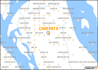
Char Pāta (Barisāl, Bangladesh)Char Pāta is a town in the Barisāl region of Bangladesh. An overview map of the region around Char Pāta is displayed below.
regional and 3d topo map of Char Pāta, Bangladesh ::
Char Pāta airports ::
The nearest airport is CGP - Chittagong Shah Amanat Intl, located 123.8 km east of Char Pāta.
Other airports nearby include DAC - Dhaka Zia Intl (137.2 km north), IXA - Agartala (150.1 km north), JSR - Jessore (167.7 km west), CXB - Cox's Bazar Coxs Bazar (186.0 km south east), Nearby towns ::
North Dīghaldi (1.9km south) //
Nalgora Char (1.9km south) //
Char Kumāria (1.7km west) //
Char Sibpur (1.9km north) //
Char Ratanpur (2.5km north west) //
North Char Lamchhi Pāta (2.5km north east) //
Bara Char Lāmchhi Pāta (2.5km north east) //
Gazaria (3.4km west) //
Char Jangla (3.7km north) //
Char Chhota Lamchhi Pāta (3.4km east) //
Mautupi (3.9km north west) //
Sāchia (3.9km north west) //
Jaynagar (4.1km south east) //
Kāthāli (4.1km north west) //
Char Jangālia (4.1km north west) //
Sifali (5.0km north west) //
Char Didārulla (5.0km south east) //
Medua (5.0km north east) //
Medua (5.1km east) //
Jaygopi (5.1km west) //
Dākātia Megara (5.5km east) //
South Char Lāmchhi Pāta (5.5km east) //
Khās Khola (5.5km west) //
Nabipura (5.8km north) //
Chhota Char Samāia (5.5km west) //
Rohita (5.5km west) //
Kālikirti (5.8km north) //
Chatla (6.3km south west) //
Char Khalifa (6.3km south east) //
[all distances 'as the bird flies' and approximate] 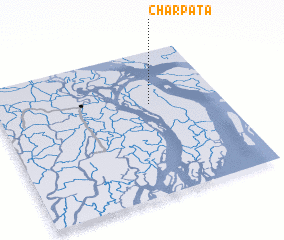 Places with similar names to Char Pāta, Bangladesh ::
// Char Pāta (BD)
// Char Pāta (BD)
// Charapotó (EC)
// Shirpud (EC)
// Charapuato (MX)
// Shiripata (PE)
// Shiripata (PE)
// Chiruppiddi (LK)
// Cherepet' (RU)
// (( Chirpiţi )) (MD)
Disclaimer :: Information on this page comes without warranty of any kind |
||
|
Where is Char Pāta? Elevation and coordinates ::
Latitude (lat): 22°38'0"N Longitude (lon): 90°41'0"E
Elevation (approx.): 10m (map arrows pan, magnifying glasses zoom) |
||
|
Visiting Char Pāta? Hotel/Accommodation ::
Book a hotel in Char Pāta Travel Guide ::
Buy a travel guide for Bangladesh rental cars ::
car rental offers GPS waypoint ::
download a GPX waypoint (PoI) of Char Pāta for your GPS receiver
|
||