|
search place name
|
||
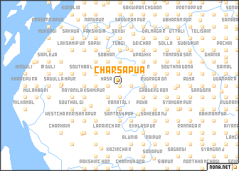
Char Sāpua (Barisāl, Bangladesh)Char Sāpua is a town in the Barisāl region of Bangladesh. An overview map of the region around Char Sāpua is displayed below.
regional and 3d topo map of Char Sāpua, Bangladesh ::
Char Sāpua airports ::
The nearest airport is DAC - Dhaka Zia Intl, located 85.1 km north of Char Sāpua.
Other airports nearby include IXA - Agartala (99.1 km north east), CGP - Chittagong Shah Amanat Intl (149.2 km south east), JSR - Jessore (159.4 km west), IXH - Kailashahar (185.1 km north east), Nearby towns ::
Chiraka (0.0km north) //
Bhātiālpur (1.7km east) //
Char Kumira (1.7km east) //
Gudāra Char (1.7km east) //
Char Mathura (1.7km east) //
Kumira Mathura Char (1.7km east) //
Sāpua (1.9km south) //
Char Rāghab Rāy (1.9km south) //
Char Rāmpur (1.9km south) //
Lām Char (1.9km south) //
Char Bhāgal (1.9km north) //
Chāndpur (1.9km north) //
Hāsa (1.7km west) //
Gobindapur (2.5km south west) //
Hāoākāndi (2.5km south west) //
Keorāchar (3.4km east) //
Farīdganj (3.4km east) //
Ranātali (3.7km south) //
Putia (3.7km south) //
Pratyāsi (3.7km north) //
Dhānua (3.7km north) //
Bhingulia (3.4km west) //
Char Hogla (3.9km south east) //
Char Pāra (3.9km south east) //
Char Basanta (3.9km north east) //
Mīrpur (3.9km north east) //
Rāmpur Hāt (4.1km south west) //
Naldugi (4.1km south west) //
Durgādi (4.1km north west) //
[all distances 'as the bird flies' and approximate] 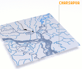 Places with similar names to Char Sāpua, Bangladesh ::
// Cherespay (VE)
Disclaimer :: Information on this page comes without warranty of any kind |
||
|
Where is Char Sāpua? Elevation and coordinates ::
Latitude (lat): 23°8'0"N Longitude (lon): 90°43'0"E
Elevation (approx.): 12m (map arrows pan, magnifying glasses zoom) |
||
|
Visiting Char Sāpua? Hotel/Accommodation ::
Book a hotel in Char Sāpua Travel Guide ::
Buy a travel guide for Bangladesh rental cars ::
car rental offers GPS waypoint ::
download a GPX waypoint (PoI) of Char Sāpua for your GPS receiver
|
||