|
search place name
|
||
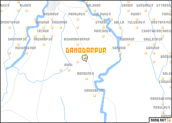
Dāmodarpur (Barisāl, Bangladesh)Dāmodarpur is a town in the Barisāl region of Bangladesh. An overview map of the region around Dāmodarpur is displayed below.
regional and 3d topo map of Dāmodarpur, Bangladesh ::
Dāmodarpur airports ::
The nearest airport is SPD - Saidpur, located 35.6 km north east of Dāmodarpur.
Other airports nearby include RJH - Rajshahi Shah Mokhdum (118.0 km south), COH - Cooch-behar Cooch Behar (119.9 km north east), IXB - Baghdogra Bagdogra (136.0 km north), IRD - Ishurdi (153.4 km south), Nearby towns ::
Dānihāri (1.9km north) //
Gahangāchhi (1.7km west) //
Baragrām (3.7km south) //
Sālki (3.8km north east) //
Biswambharpur (4.1km north west) //
Āihāi (3.8km south west) //
Dānur (5.3km west) //
Pānchkur (6.5km north east) //
Samjhia (6.9km east) //
Dakshin Gosāinpur (7.6km north) //
Kāmdebpur (7.6km south) //
Uthrāil (8.1km north east) //
Kāsimpur (9.0km north west) //
Tājpur (8.7km north west) //
Mahishkota (10.0km north west) //
Dalla (10.0km north east) //
[all distances 'as the bird flies' and approximate] 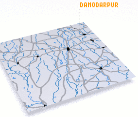 Places with similar names to Dāmodarpur, Bangladesh ::
Disclaimer :: Information on this page comes without warranty of any kind |
||
|
Where is Dāmodarpur? Elevation and coordinates ::
Latitude (lat): 25°30'0"N Longitude (lon): 88°42'0"E
Elevation (approx.): 33m (map arrows pan, magnifying glasses zoom) |
||
|
Visiting Dāmodarpur? Hotel/Accommodation ::
Book a hotel in Dāmodarpur Travel Guide ::
Buy a travel guide for Bangladesh rental cars ::
car rental offers GPS waypoint ::
download a GPX waypoint (PoI) of Dāmodarpur for your GPS receiver
|
||