|
search place name
|
||
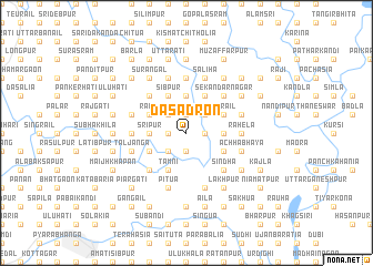
Dasadron (Barisāl, Bangladesh)Dasadron is a town in the Barisāl region of Bangladesh. An overview map of the region around Dasadron is displayed below.
regional and 3d topo map of Dasadron, Bangladesh ::
Dasadron airports ::
The nearest airport is IXA - Agartala, located 81.0 km south east of Dasadron.
Other airports nearby include DAC - Dhaka Zia Intl (90.1 km south west), ZYL - Sylhet Osmani Osmany Intl (111.8 km north east), IXH - Kailashahar (118.3 km east), IRD - Ishurdi (189.2 km west), Nearby towns ::
Char Karansi (1.9km south) //
Pāikpāra (1.7km east) //
Dāriāpur (1.9km north) //
Sāmukjāni (1.9km north) //
Nandīpur (1.7km west) //
Deothān (1.7km west) //
Simulāti (1.9km north) //
Dari Jahāngīrpur (1.7km west) //
Nowāgaon (2.5km south west) //
Khod Karansi (2.5km south west) //
Banda Gomāra (2.5km south west) //
Sahilāti (2.5km north east) //
Sāchāil (2.5km north east) //
Pang Pāchiha (2.5km north east) //
Hāzipur (2.5km north west) //
Baruha (3.4km east) //
Srīpur (3.4km west) //
Mollāpāra (3.4km west) //
Bhātgaon (3.4km west) //
Ghoshpāra (3.4km west) //
Ārāiura (3.4km west) //
Bāhārkāndi (3.7km north) //
Barigāti (3.7km north) //
Mechhgaon (3.7km north) //
Kāchilāhāti (3.8km south east) //
Tāmni (4.1km south west) //
Tārāil (3.8km north east) //
Mākhnārbanda (3.8km north east) //
Kālna (3.8km north east) //
[all distances 'as the bird flies' and approximate] 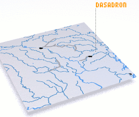 Places with similar names to Dasadron, Bangladesh ::
Disclaimer :: Information on this page comes without warranty of any kind |
||
|
Where is Dasadron? Elevation and coordinates ::
Latitude (lat): 24°32'0"N Longitude (lon): 90°52'0"E
Elevation (approx.): 6m (map arrows pan, magnifying glasses zoom) |
||
|
Visiting Dasadron? Hotel/Accommodation ::
Book a hotel in Dasadron Travel Guide ::
Buy a travel guide for Bangladesh rental cars ::
car rental offers GPS waypoint ::
download a GPX waypoint (PoI) of Dasadron for your GPS receiver
|
||