|
search place name
|
||
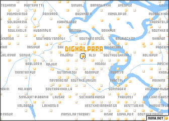
Dighalpāra (Barisāl, Bangladesh)Dighalpāra is a town in the Barisāl region of Bangladesh. An overview map of the region around Dighalpāra is displayed below.
regional and 3d topo map of Dighalpāra, Bangladesh ::
Dighalpāra airports ::
The nearest airport is DAC - Dhaka Zia Intl, located 75.1 km north of Dighalpāra.
Other airports nearby include JSR - Jessore (97.9 km west), IXA - Agartala (136.7 km north east), IRD - Ishurdi (150.3 km north west), CCU - Calcutta Netaji Subhash Chandra Bose Intl (182.2 km west), Nearby towns ::
Kendua (0.0km north) //
Khātapāra (0.0km north) //
Khāmārpāra (0.0km north) //
Tithirpāra (0.0km north) //
Subandi Dhāraikāndi (0.0km north) //
Sonāpāra (1.9km north) //
Kuchiāmora (1.9km north) //
Kalima (1.9km north) //
Āsāpat (1.7km east) //
Kālāpur (1.7km east) //
Daulatpur (1.7km east) //
Diāpāra (1.7km east) //
Ālgi (1.7km east) //
Ādityapur (1.9km south) //
Kunia Bharuāpāra (1.9km south) //
Khādānsi (1.9km south) //
Ārāipāra (1.7km west) //
Dārādia (1.7km west) //
Sātbāria (2.5km north west) //
Hugli (2.5km south east) //
Mājhchar (2.5km south west) //
Ballabhdi (3.6km north) //
Sirkhāra (3.7km north) //
Rājdhardi (3.4km east) //
Chandibardi (3.4km east) //
Rājandi (3.4km west) //
Srīnāthdi (3.7km south) //
Nisābdi (3.7km south) //
Datterhāt (3.7km south) //
[all distances 'as the bird flies' and approximate]  Places with similar names to Dighalpāra, Bangladesh ::
// Daphlāpur (IN)
// Devalapura (IN)
Disclaimer :: Information on this page comes without warranty of any kind |
||
|
Where is Dighalpāra? Elevation and coordinates ::
Latitude (lat): 23°13'0"N Longitude (lon): 90°7'0"E
Elevation (approx.): 6m (map arrows pan, magnifying glasses zoom) |
||
|
Visiting Dighalpāra? Hotel/Accommodation ::
Book a hotel in Dighalpāra Travel Guide ::
Buy a travel guide for Bangladesh rental cars ::
car rental offers GPS waypoint ::
download a GPX waypoint (PoI) of Dighalpāra for your GPS receiver
|
||