|
search place name
|
||
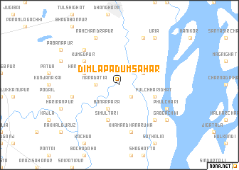
Dimla Padumsahar (Barisāl, Bangladesh)Dimla Padumsahar is a town in the Barisāl region of Bangladesh. An overview map of the region around Dimla Padumsahar is displayed below.
regional and 3d topo map of Dimla Padumsahar, Bangladesh ::
Dimla Padumsahar airports ::
The nearest airport is SPD - Saidpur, located 88.1 km north west of Dimla Padumsahar.
Other airports nearby include COH - Cooch-behar Cooch Behar (123.7 km north), RJH - Rajshahi Shah Mokhdum (127.9 km south west), IRD - Ishurdi (128.3 km south west), DAC - Dhaka Zia Intl (174.7 km south east), Nearby towns ::
Tepa Padumsahar (2.5km south east) //
Marādātia (3.4km west) //
Kātlāmāri (3.8km north east) //
Bonārpāra (4.1km south west) //
Harināthpur (5.4km west) //
Fulchharighat (5.4km east) //
Simultari (5.8km south) //
Kumedpur (6.2km north west) //
Krorgāchha (7.0km west) //
Khāmār Dhanāruha (7.6km south) //
Manoharpur (7.5km north west) //
Bharatkhāli (7.5km south east) //
Ramchandrapur (8.1km north west) //
Burāil (8.1km north east) //
Phulchari (7.7km south east) //
Uria (9.0km north east) //
Gābgāchhi (8.7km south east) //
[all distances 'as the bird flies' and approximate] 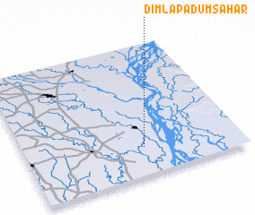 Places with similar names to Dimla Padumsahar, Bangladesh :: Disclaimer :: Information on this page comes without warranty of any kind |
||
|
Where is Dimla Padumsahar? Elevation and coordinates ::
Latitude (lat): 25°13'0"N Longitude (lon): 89°33'0"E
Elevation (approx.): 21m (map arrows pan, magnifying glasses zoom) |
||
|
Visiting Dimla Padumsahar? Hotel/Accommodation ::
Book a hotel in Dimla Padumsahar Travel Guide ::
Buy a travel guide for Bangladesh rental cars ::
car rental offers GPS waypoint ::
download a GPX waypoint (PoI) of Dimla Padumsahar for your GPS receiver
|
||