|
search place name
|
||
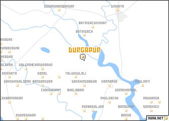
Durgāpur (Barisāl, Bangladesh)Durgāpur is a town in the Barisāl region of Bangladesh. An overview map of the region around Durgāpur is displayed below.
regional and 3d topo map of Durgāpur, Bangladesh ::
Durgāpur airports ::
The nearest airport is COH - Cooch-behar Cooch Behar, located 33.6 km north of Durgāpur.
Other airports nearby include SPD - Saidpur (57.8 km south west), IXB - Baghdogra Bagdogra (128.8 km north west), PBH - Paro (151.8 km north), RJH - Rajshahi Shah Mokhdum (193.6 km south west), Nearby towns ::
Tāluk Dulāli (4.1km south west) //
Dakshin Gobdha (5.6km south) //
Bātrigāch (5.6km north) //
Mālgāra (6.2km south west) //
Bhelābāri (7.6km south) //
Bātrigāch Kismat (7.6km north) //
Karnāpur (7.5km south east) //
Bara Kamalābāri (8.9km south west) //
Chandan Pat (10.0km south west) //
[all distances 'as the bird flies' and approximate] 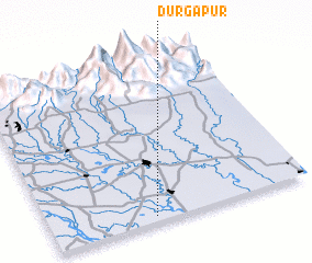 Places with similar names to Durgāpur, Bangladesh ::
Disclaimer :: Information on this page comes without warranty of any kind |
||
|
Where is Durgāpur? Elevation and coordinates ::
Latitude (lat): 26°2'0"N Longitude (lon): 89°24'0"E
Elevation (approx.): 37m (map arrows pan, magnifying glasses zoom) |
||
|
Visiting Durgāpur? Hotel/Accommodation ::
Book a hotel in Durgāpur Travel Guide ::
Buy a travel guide for Bangladesh rental cars ::
car rental offers GPS waypoint ::
download a GPX waypoint (PoI) of Durgāpur for your GPS receiver
|
||