|
search place name
|
||
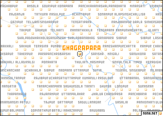
Ghāgrāpāra (Barisāl, Bangladesh)Ghāgrāpāra is a town in the Barisāl region of Bangladesh. An overview map of the region around Ghāgrāpāra is displayed below.
regional and 3d topo map of Ghāgrāpāra, Bangladesh ::
Ghāgrāpāra airports ::
The nearest airport is DAC - Dhaka Zia Intl, located 94.3 km south of Ghāgrāpāra.
Other airports nearby include IXA - Agartala (106.1 km south east), ZYL - Sylhet Osmani Osmany Intl (129.0 km east), IXH - Kailashahar (144.8 km east), IRD - Ishurdi (170.4 km west), Nearby towns ::
Tangtangia (0.0km north) //
Nij Tulandar (0.0km north) //
Manoharpur (0.0km north) //
Eoznagar (0.0km north) //
Bālisita (1.9km north) //
Darun Barabhāg (1.9km north) //
Chati (1.9km north) //
Char Saiyad Bhākuri (1.9km north) //
Kumra Sāsan (1.7km west) //
Sanchāpur (1.7km west) //
Khairāti (1.7km west) //
Mājhiākāndi (1.7km west) //
Ināyetpur (1.7km east) //
Darianda (1.7km east) //
Durgāpāra (1.9km south) //
Māliāti (1.9km south) //
Thuliāti (1.9km south) //
Khalilnagar (1.7km east) //
Tāngangāti (1.9km south) //
Tārākāndi (2.5km north west) //
Bhāidgaon (2.5km north west) //
Hātulia (2.5km north east) //
Sāhebnagar (2.5km north east) //
Tera Chāti (2.5km south west) //
Hārua (2.5km south west) //
Sādārpāra (2.5km south west) //
Bānsāti (2.5km south east) //
Lāngāil (2.5km south east) //
Phānur (2.5km south east) //
[all distances 'as the bird flies' and approximate] 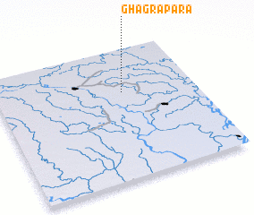 Places with similar names to Ghāgrāpāra, Bangladesh ::
Disclaimer :: Information on this page comes without warranty of any kind |
||
|
Where is Ghāgrāpāra? Elevation and coordinates ::
Latitude (lat): 24°40'0"N Longitude (lon): 90°38'0"E
Elevation (approx.): 15m (map arrows pan, magnifying glasses zoom) |
||
|
Visiting Ghāgrāpāra? Hotel/Accommodation ::
Book a hotel in Ghāgrāpāra Travel Guide ::
Buy a travel guide for Bangladesh rental cars ::
car rental offers GPS waypoint ::
download a GPX waypoint (PoI) of Ghāgrāpāra for your GPS receiver
|
||