|
search place name
|
||
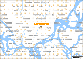
Giribardi (Barisāl, Bangladesh)Giribardi is a town in the Barisāl region of Bangladesh. An overview map of the region around Giribardi is displayed below.
regional and 3d topo map of Giribardi, Bangladesh ::
Giribardi airports ::
The nearest airport is DAC - Dhaka Zia Intl, located 28.6 km north west of Giribardi.
Other airports nearby include IXA - Agartala (71.9 km east), JSR - Jessore (154.3 km west), IXH - Kailashahar (162.2 km north east), IRD - Ishurdi (165.8 km west), Nearby towns ::
Uttamdi (0.0km north) //
Dakshin Chandibardi (0.0km north) //
Uttar Chandibardi (0.0km north) //
Jhagra Khola (0.0km north) //
Mallikerpāra (0.0km north) //
Chhota Krishnādi (0.0km north) //
Ratandi (0.0km north) //
Rāmdi (0.0km north) //
Srīnibāsdi (0.0km north) //
Char Safīkhān (0.0km north) //
Chhota Silmāndi (0.0km north) //
Maghbāzar (0.0km north) //
Bāgbāri (0.0km north) //
Padmalābhdi (0.0km north) //
Nāzirpur (0.0km north) //
Bāg Nāzirpur (0.0km north) //
Chhota Mājher Char (1.7km west) //
Bābrakput (1.7km west) //
Kāzirgaon (1.7km west) //
Serpur (1.7km west) //
Sonākhāli (1.7km west) //
Mādhabpur (1.7km west) //
Matbāri (1.7km east) //
Chhota Tilak (1.7km east) //
Bālia Dīghirpār (1.7km east) //
Arjjundi (1.7km east) //
Islāmpatti (1.7km east) //
Kānāinagar (1.7km east) //
Balarāmpur (1.7km east) //
[all distances 'as the bird flies' and approximate]  Places with similar names to Giribardi, Bangladesh ::
// Jraberd (AZ)
Disclaimer :: Information on this page comes without warranty of any kind |
||
|
Where is Giribardi? Elevation and coordinates ::
Latitude (lat): 23°39'0"N Longitude (lon): 90°35'0"E
Elevation (approx.): 8m (map arrows pan, magnifying glasses zoom) |
||
|
Visiting Giribardi? Hotel/Accommodation ::
Book a hotel in Giribardi Travel Guide ::
Buy a travel guide for Bangladesh rental cars ::
car rental offers GPS waypoint ::
download a GPX waypoint (PoI) of Giribardi for your GPS receiver
|
||