|
search place name
|
||
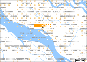
Harichandi (Barisāl, Bangladesh)Harichandi is a town in the Barisāl region of Bangladesh. An overview map of the region around Harichandi is displayed below.
regional and 3d topo map of Harichandi, Bangladesh ::
Harichandi airports ::
The nearest airport is DAC - Dhaka Zia Intl, located 39.4 km north east of Harichandi.
Other airports nearby include JSR - Jessore (107.3 km south west), IXA - Agartala (120.1 km east), IRD - Ishurdi (122.3 km north west), RJH - Rajshahi Shah Mokhdum (176.2 km north west), Nearby towns ::
Char Rup (0.0km north) //
Bara Rāmnāthpur (0.0km north) //
Bilāspur (0.0km north) //
Ārita (1.9km north) //
Māhātābnagar (1.9km north) //
Maulavidāngi (1.9km north) //
Bara Ekrasi (1.9km north) //
Raghudebpur (1.9km north) //
Jaymangal (1.9km north) //
Char Kusāi (1.7km west) //
Char Baita (1.7km west) //
Rāipāra (1.7km east) //
Latākhola (1.7km east) //
Bara Bāsta (2.5km north west) //
Chhota Hānrikānda (2.5km north west) //
Kānthālighāta (2.5km north east) //
Chhota Ekrasi (2.5km north east) //
Rādhānagar (2.5km south east) //
Batia (2.5km south east) //
Chhota Rāmnāthpur (2.5km south east) //
Nūrpur (2.5km south east) //
Purba Char (2.5km south east) //
Mājhir Char (2.5km south east) //
Joypāra (2.7km east) //
Puākāir (3.7km north) //
Munshinagar (3.7km north) //
Kundākhāli (3.4km east) //
Laskarkānda (3.4km east) //
Isufpur (3.4km east) //
[all distances 'as the bird flies' and approximate]  Places with similar names to Harichandi, Bangladesh ::
Disclaimer :: Information on this page comes without warranty of any kind |
||
|
Where is Harichandi? Elevation and coordinates ::
Latitude (lat): 23°37'0"N Longitude (lon): 90°6'0"E
Elevation (approx.): 7m (map arrows pan, magnifying glasses zoom) |
||
|
Visiting Harichandi? Hotel/Accommodation ::
Book a hotel in Harichandi Travel Guide ::
Buy a travel guide for Bangladesh rental cars ::
car rental offers GPS waypoint ::
download a GPX waypoint (PoI) of Harichandi for your GPS receiver
|
||