|
search place name
|
||
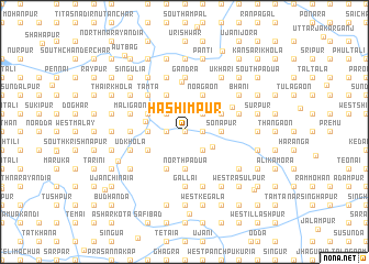
Hāshimpur (Barisāl, Bangladesh)Hāshimpur is a town in the Barisāl region of Bangladesh. An overview map of the region around Hāshimpur is displayed below.
regional and 3d topo map of Hāshimpur, Bangladesh ::
Hāshimpur airports ::
The nearest airport is IXA - Agartala, located 56.6 km north east of Hāshimpur.
Other airports nearby include DAC - Dhaka Zia Intl (64.9 km north west), IXH - Kailashahar (145.1 km north east), CGP - Chittagong Shah Amanat Intl (165.7 km south east), JSR - Jessore (180.9 km west), Nearby towns ::
Sātgaon (0.0km north) //
North Krishnapur (0.0km north) //
Bātāghāshi (0.0km north) //
Nāzirpur (0.0km north) //
Murādpur (1.7km east) //
Srīrāmpur (1.7km east) //
Ponshāi (1.7km east) //
Jorpuni (1.7km east) //
Dālpāra (1.7km west) //
Murādnagar (1.7km west) //
Ghātighara (2.5km south east) //
Bāmatia (2.5km south east) //
West Ambarpur (2.5km south east) //
Parchanga (2.5km south east) //
Bākhrābād (2.5km north east) //
Tir Cho (2.5km north west) //
Sābdalpur (2.5km north west) //
Suhilpur (2.5km north west) //
Nij Mahichāl (3.0km south east) //
Sonāpur (3.4km east) //
Chhota Sāorātali (3.4km east) //
Kāsimpur (3.4km east) //
North Padua (3.7km south) //
Kāngāi (3.7km south) //
Mohanpur (3.7km south) //
Bāuchāil (3.7km south) //
Kesara (3.7km south) //
North Nūrpur (3.4km west) //
Madhyagaon (3.4km west) //
[all distances 'as the bird flies' and approximate]  Places with similar names to Hāshimpur, Bangladesh ::
Disclaimer :: Information on this page comes without warranty of any kind |
||
|
Where is Hāshimpur? Elevation and coordinates ::
Latitude (lat): 23°29'0"N Longitude (lon): 90°54'0"E
Elevation (approx.): 9m (map arrows pan, magnifying glasses zoom) |
||
|
Visiting Hāshimpur? Hotel/Accommodation ::
Book a hotel in Hāshimpur Travel Guide ::
Buy a travel guide for Bangladesh rental cars ::
car rental offers GPS waypoint ::
download a GPX waypoint (PoI) of Hāshimpur for your GPS receiver
|
||