|
search place name
|
||
Jhālpāra (Barisāl, Bangladesh)Jhālpāra is a town in the Barisāl region of Bangladesh. An overview map of the region around Jhālpāra is displayed below.
regional and 3d topo map of Jhālpāra, Bangladesh ::

Jhālpāra airports ::
The nearest airport is DAC - Dhaka Zia Intl, located 51.5 km south west of Jhālpāra.
Other airports nearby include IXA - Agartala (66.0 km south east), IXH - Kailashahar (133.1 km east), ZYL - Sylhet Osmani Osmany Intl (144.2 km north east), IRD - Ishurdi (167.9 km west), Nearby towns ::
Dighirpār (0.0km north) //
Lemutola (0.0km north) //
Gāngkul (1.9km north) //
Dharubāndha (1.7km east) //
Tātirdi (1.9km south) //
Char Sāgardi (1.7km east) //
Hājikhāner Char (1.7km west) //
Dāierpāra (1.9km south) //
Char Khāma (2.5km north east) //
Sarifpur (2.5km north east) //
Tārākāndi (2.5km south west) //
Purba Char Durlabh Khān (2.5km south west) //
Jālār Char (2.5km south west) //
Narapati (3.7km north) //
Khāma (3.7km north) //
Mirdi (3.7km north) //
Pāchua (3.4km west) //
Sekhergaon (3.7km south) //
Joār Gajāria (3.7km south) //
Gājaria (3.7km south) //
Kismat Āhāmmadpur (3.9km north east) //
Ārālia (3.9km north west) //
Narendrapur (3.9km south east) //
Māndārkāndi (4.1km north east) //
Deokāndi (4.1km north west) //
Digāmbārdi (4.1km north east) //
Bhikārtek (3.9km south west) //
Barjāpur (3.9km south west) //
Nalua Chak (4.1km south east) //
[all distances 'as the bird flies' and approximate] 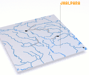 Places with similar names to Jhālpāra, Bangladesh ::
Disclaimer :: Information on this page comes without warranty of any kind |
||
|
Where is Jhālpāra? Elevation and coordinates ::
Latitude (lat): 24°13'0"N Longitude (lon): 90°42'0"E
Elevation (approx.): 11m (map arrows pan, magnifying glasses zoom) |
||
|
Visiting Jhālpāra? Hotel/Accommodation ::
Book a hotel in Jhālpāra Travel Guide ::
Buy a travel guide for Bangladesh rental cars ::
car rental offers GPS waypoint ::
download a GPX waypoint (PoI) of Jhālpāra for your GPS receiver
|
||