|
search place name
|
||
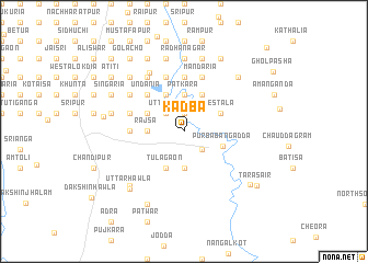
Kādba (Barisāl, Bangladesh)Kādba is a town in the Barisāl region of Bangladesh. An overview map of the region around Kādba is displayed below.
regional and 3d topo map of Kādba, Bangladesh ::
Kādba airports ::
The nearest airport is IXA - Agartala, located 72.4 km north of Kādba.
Other airports nearby include DAC - Dhaka Zia Intl (107.5 km north west), CGP - Chittagong Shah Amanat Intl (125.0 km south east), IXH - Kailashahar (143.7 km north east), AJL - Aizwal Aizawl (171.7 km east), Nearby towns ::
Sādhur Kalamia (1.9km north) //
Mitālla (1.9km north) //
Purba Laksam (2.3km north) //
Bāngodda (2.5km south east) //
Srīpur (2.5km north west) //
Uttarda (2.5km north west) //
Māhini (3.7km south) //
Bijaipur (3.7km north) //
Paikpāra (3.7km north) //
Hājāripāra (3.7km north) //
Pātkāra (3.7km north) //
Rājsa (3.4km west) //
Mestala (3.9km north east) //
Tulāgaon (4.1km south west) //
Dalua (4.1km north east) //
Tulātali (4.1km north west) //
Bātābāria (4.1km north west) //
Gaiyārbhānga (4.1km north west) //
Pālpāra (4.1km north west) //
Bhātistala (3.9km north west) //
Premnal (3.9km north west) //
Bichhankhola (3.9km north west) //
Purba Bangadda (3.9km south east) //
Undānia (5.0km north west) //
Telīpāra (5.0km north west) //
Pāroain (5.0km north west) //
Bhānga Pushkarini (5.6km north) //
Kāchāripāra (5.6km north) //
Phūlgaon (5.1km west) //
[all distances 'as the bird flies' and approximate]  Places with similar names to Kādba, Bangladesh ::
Disclaimer :: Information on this page comes without warranty of any kind |
||
|
Where is Kādba? Elevation and coordinates ::
Latitude (lat): 23°14'0"N Longitude (lon): 91°13'0"E
Elevation (approx.): 12m (map arrows pan, magnifying glasses zoom) |
||
|
Visiting Kādba? Hotel/Accommodation ::
Book a hotel in Kādba Travel Guide ::
Buy a travel guide for Bangladesh rental cars ::
car rental offers GPS waypoint ::
download a GPX waypoint (PoI) of Kādba for your GPS receiver
|
||