|
search place name
|
||
Kāgār Char (Barisāl, Bangladesh)Kāgār Char is a town in the Barisāl region of Bangladesh. An overview map of the region around Kāgār Char is displayed below.
regional and 3d topo map of Kāgār Char, Bangladesh ::

Kāgār Char airports ::
The nearest airport is DAC - Dhaka Zia Intl, located 56.1 km south west of Kāgār Char.
Other airports nearby include IXA - Agartala (69.2 km south east), IXH - Kailashahar (132.8 km east), ZYL - Sylhet Osmani Osmany Intl (141.1 km north east), IRD - Ishurdi (168.1 km west), Nearby towns ::
Mullādi (1.9km north) //
Ālamdi (1.9km north) //
Kāheterdia (1.9km north) //
Khāma (1.9km south) //
Mirdi (1.9km south) //
Narapati (1.9km south) //
Tāldāsi (1.7km west) //
Putia (1.7km east) //
Barudia (1.7km east) //
Chāmrāid (1.7km west) //
Bejurdia (2.5km north east) //
Bil Bhara (2.5km north west) //
Pābda (2.5km north east) //
Āngiādi (2.5km north west) //
Māndārkāndi (2.5km south east) //
Deokāndi (2.5km south west) //
Digāmbārdi (2.5km south east) //
Kareha (3.4km east) //
Hosendi (3.7km north) //
Kandarpadi (3.7km north) //
Ādityāpāsa (3.7km north) //
Egāra Sindur (3.4km west) //
Māzidpur (3.4km west) //
Sukrābād (3.4km west) //
Gāngkul (3.7km south) //
Sāluadi (3.9km north east) //
Beldi (3.9km north east) //
Kāmār Kona (3.9km north west) //
Meher Dhanbāri (3.9km north west) //
[all distances 'as the bird flies' and approximate] 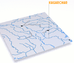 Places with similar names to Kāgār Char, Bangladesh ::
// Cucarachero (CO)
Disclaimer :: Information on this page comes without warranty of any kind |
||
|
Where is Kāgār Char? Elevation and coordinates ::
Latitude (lat): 24°16'0"N Longitude (lon): 90°42'0"E
Elevation (approx.): 12m (map arrows pan, magnifying glasses zoom) |
||
|
Visiting Kāgār Char? Hotel/Accommodation ::
Book a hotel in Kāgār Char Travel Guide ::
Buy a travel guide for Bangladesh rental cars ::
car rental offers GPS waypoint ::
download a GPX waypoint (PoI) of Kāgār Char for your GPS receiver
|
||