|
search place name
|
||
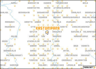
Kasturipāra (Barisāl, Bangladesh)Kasturipāra is a town in the Barisāl region of Bangladesh. An overview map of the region around Kasturipāra is displayed below.
regional and 3d topo map of Kasturipāra, Bangladesh ::
Kasturipāra airports ::
The nearest airport is DAC - Dhaka Zia Intl, located 69.5 km south east of Kasturipāra.
Other airports nearby include IRD - Ishurdi (104.8 km west), IXA - Agartala (132.9 km south east), RJH - Rajshahi Shah Mokhdum (145.5 km west), JSR - Jessore (160.8 km south west), Nearby towns ::
Chak Sonāil (1.9km south) //
Bhāndeswar (1.9km south) //
Purbba Sunda (1.9km north) //
Rauha (1.7km east) //
Banbāri (1.7km west) //
Bhengula (1.7km east) //
Singna Kuturia (1.7km west) //
Tebi (2.5km south west) //
Joāir (2.5km south west) //
Āolātail (2.5km south east) //
Laskarpur (2.5km south east) //
Bhiāil (2.5km north east) //
Bāgunta (2.5km north west) //
Chhota Bhandeswar (2.5km north west) //
Nārāngāil (2.5km north west) //
Bir Basunda (2.5km north west) //
Rājāfair (2.5km north west) //
Dhaluābāri (2.5km north west) //
Pāchh Joāir (3.4km west) //
Haripur (3.4km west) //
Betdoba (3.4km west) //
Bhuia Kāmārthi (3.4km west) //
Nāgbāri (3.7km south) //
Khāluābāri (3.7km south) //
Naoāpāra (3.7km south) //
Pākutia (3.7km south) //
Rājābāri (3.4km east) //
Pārki (3.4km east) //
Rasulpur (3.4km east) //
[all distances 'as the bird flies' and approximate] 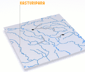 Places with similar names to Kasturipāra, Bangladesh :: Disclaimer :: Information on this page comes without warranty of any kind |
||
|
Where is Kasturipāra? Elevation and coordinates ::
Latitude (lat): 24°23'0"N Longitude (lon): 90°3'0"E
Elevation (approx.): 12m (map arrows pan, magnifying glasses zoom) |
||
|
Visiting Kasturipāra? Hotel/Accommodation ::
Book a hotel in Kasturipāra Travel Guide ::
Buy a travel guide for Bangladesh rental cars ::
car rental offers GPS waypoint ::
download a GPX waypoint (PoI) of Kasturipāra for your GPS receiver
|
||