|
search place name
|
||
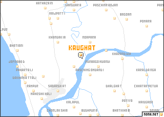
Kaughāt (Barisāl, Bangladesh)Kaughāt is a town in the Barisāl region of Bangladesh. An overview map of the region around Kaughāt is displayed below.
regional and 3d topo map of Kaughāt, Bangladesh ::
Kaughāt airports ::
The nearest airport is CGP - Chittagong Shah Amanat Intl, located 18.1 km south west of Kaughāt.
Other airports nearby include CXB - Cox's Bazar Coxs Bazar (105.3 km south), AJL - Aizwal Aizawl (176.4 km north east), IXA - Agartala (177.4 km north), IXH - Kailashahar (211.7 km north), Nearby towns ::
Janāli Hāt (2.5km south west) //
Paschim Gomdandi (4.1km south east) //
Noāpāra (4.1km north east) //
Purba Gomdandi (3.9km south east) //
Charandwīp (5.5km east) //
Khandakia (6.3km north west) //
Chikandandi (6.3km north west) //
Sadar Ghāt (9.0km south west) //
Chittagong Port (9.0km south west) //
Chittagong (9.2km south west) //
Dhalghāt (10.1km south east) //
Fatehpur (10.4km north west) //
[all distances 'as the bird flies' and approximate] 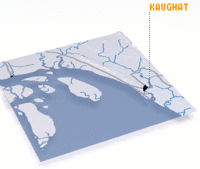 Places with similar names to Kaughāt, Bangladesh ::
Disclaimer :: Information on this page comes without warranty of any kind |
||
|
Where is Kaughāt? Elevation and coordinates ::
Latitude (lat): 22°24'0"N Longitude (lon): 91°53'0"E
Elevation (approx.): 7m (map arrows pan, magnifying glasses zoom) |
||
|
Visiting Kaughāt? Hotel/Accommodation ::
Book a hotel in Kaughāt Travel Guide ::
Buy a travel guide for Bangladesh rental cars ::
car rental offers GPS waypoint ::
download a GPX waypoint (PoI) of Kaughāt for your GPS receiver
|
||