|
search place name
|
||
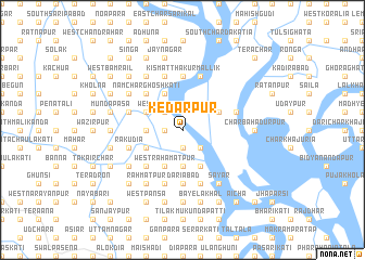
Kedārpur (Barisāl, Bangladesh)Kedārpur is a town in the Barisāl region of Bangladesh. An overview map of the region around Kedārpur is displayed below.
regional and 3d topo map of Kedārpur, Bangladesh ::
Kedārpur airports ::
The nearest airport is DAC - Dhaka Zia Intl, located 112.1 km north of Kedārpur.
Other airports nearby include JSR - Jessore (126.3 km west), IXA - Agartala (149.1 km north east), CGP - Chittagong Shah Amanat Intl (165.4 km south east), CCU - Calcutta Netaji Subhash Chandra Bose Intl (194.8 km west), Nearby towns ::
Bābuganj (1.9km south) //
Lohālia (1.9km south) //
South Bhutardia (1.7km west) //
Rājguru (2.5km south east) //
West Bhutardia (2.5km north west) //
Bhutardia (2.5km north west) //
Sinherkāti (3.7km south) //
Ārāzi Kālikāpur (3.7km south) //
Kālikāpur (3.7km south) //
Olankāti (3.7km south) //
Bāhir Char Kshudrakāti (3.4km west) //
Chāndpāsa Kismat (4.1km south west) //
Rājkar (4.1km south west) //
West Rahamatpur (4.1km south west) //
Mānikkāti (3.9km south west) //
Dwārika (3.9km south west) //
Kshudrakāti (3.9km south west) //
Rafiādi (4.1km south east) //
Kumariārpit (4.1km south east) //
Mirganj (4.1km south east) //
Ārāzi Bāhirchar Ghoshkāti (3.9km north west) //
Brāhmandia (4.1km north west) //
Char Hesāmaddi (3.9km north east) //
North Rahamatpur (5.0km south west) //
Khāpura (5.0km south west) //
Nāmchar Ghoshkāti (5.0km north west) //
Char Ālgi (5.0km north west) //
Kayādi (5.0km north west) //
Dariābād (5.6km south) //
[all distances 'as the bird flies' and approximate]  Places with similar names to Kedārpur, Bangladesh ::
Disclaimer :: Information on this page comes without warranty of any kind |
||
|
Where is Kedārpur? Elevation and coordinates ::
Latitude (lat): 22°50'0"N Longitude (lon): 90°20'0"E
Elevation (approx.): 7m (map arrows pan, magnifying glasses zoom) |
||
|
Visiting Kedārpur? Hotel/Accommodation ::
Book a hotel in Kedārpur Travel Guide ::
Buy a travel guide for Bangladesh rental cars ::
car rental offers GPS waypoint ::
download a GPX waypoint (PoI) of Kedārpur for your GPS receiver
|
||