|
search place name
|
||
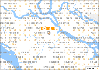
Khārsul (Barisāl, Bangladesh)Khārsul is a town in the Barisāl region of Bangladesh. An overview map of the region around Khārsul is displayed below.
regional and 3d topo map of Khārsul, Bangladesh ::
Khārsul airports ::
The nearest airport is DAC - Dhaka Zia Intl, located 26.2 km north east of Khārsul.
Other airports nearby include IXA - Agartala (104.3 km east), JSR - Jessore (122.7 km south west), IRD - Ishurdi (134.3 km north west), RJH - Rajshahi Shah Mokhdum (187.6 km north west), Nearby towns ::
Benukhāli (1.9km south) //
Girinagar (1.9km south) //
Maricha (1.7km east) //
Kānāinagar (2.5km south east) //
Gokulnagar (2.5km south west) //
Kālsur (2.5km south east) //
Daulatpur (2.5km north east) //
Āgla (3.1km west) //
Kailāil (3.6km north west) //
Mājhpāra (3.4km west) //
Purbapāra (3.4km west) //
Kāmārkānda (3.4km east) //
Bara Bāhra (3.4km west) //
Pāusār (3.7km south) //
Makimpur (3.9km south west) //
Mohanpur (3.9km south west) //
Chitrakot (3.9km south east) //
Tikarpur (3.9km south west) //
Uttar Phainpur (3.9km south east) //
Māliāil (3.9km north west) //
Shekhernagar (4.1km south east) //
Goālkhāli (4.4km north east) //
Sibarāmpur (4.6km south east) //
Char Madhucharia (5.0km south west) //
Gopālpur (5.0km south east) //
Durgāpur (5.0km south west) //
Ghanasyāmpur (5.0km south east) //
Barām (5.0km south east) //
Bilārai (5.0km south west) //
[all distances 'as the bird flies' and approximate]  Places with similar names to Khārsul, Bangladesh ::
Disclaimer :: Information on this page comes without warranty of any kind |
||
|
Where is Khārsul? Elevation and coordinates ::
Latitude (lat): 23°39'0"N Longitude (lon): 90°15'0"E
Elevation (approx.): 4m (map arrows pan, magnifying glasses zoom) |
||
|
Visiting Khārsul? Hotel/Accommodation ::
Book a hotel in Khārsul Travel Guide ::
Buy a travel guide for Bangladesh rental cars ::
car rental offers GPS waypoint ::
download a GPX waypoint (PoI) of Khārsul for your GPS receiver
|
||