|
search place name
|
||
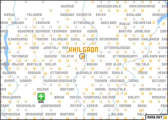
Khilgaon (Barisāl, Bangladesh)Khilgaon is a town in the Barisāl region of Bangladesh. An overview map of the region around Khilgaon is displayed below.
regional and 3d topo map of Khilgaon, Bangladesh ::
Khilgaon airports ::
The nearest airport is DAC - Dhaka Zia Intl, located 11.9 km south west of Khilgaon.
Other airports nearby include IXA - Agartala (77.2 km east), IRD - Ishurdi (148.2 km west), JSR - Jessore (157.5 km south west), IXH - Kailashahar (160.9 km east), Nearby towns ::
Chhikalia (0.0km north) //
Udur (0.0km north) //
Changerbāid (1.7km west) //
Samarsing (1.7km west) //
Nārānkul (1.7km west) //
Uzirpur (1.9km north) //
Pubāil (1.9km north) //
Rāyān (1.7km east) //
Lodaria (1.7km east) //
Gārāria (1.7km east) //
Bartul Tek (1.9km south) //
Chhota Jaynagar (1.9km south) //
Dhanun (1.7km east) //
Basugaon (2.5km north west) //
Dharpāra (2.5km north west) //
Maijgaon (2.5km north west) //
Bindān (2.5km south west) //
Birahi (2.5km north east) //
Pipulia (2.5km north east) //
Simulia (2.5km north east) //
Baghdi (2.5km south east) //
Pāroān (2.5km south east) //
Tālatia (3.4km west) //
Pāderbāid (3.4km west) //
Sātpoa (3.4km west) //
Reola (3.7km north) //
Senpāra (3.7km south) //
Bāimākānda (3.7km south) //
Kuchilābāri (3.7km south) //
[all distances 'as the bird flies' and approximate] 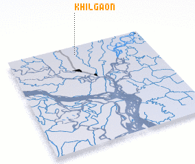 Places with similar names to Khilgaon, Bangladesh ::
Disclaimer :: Information on this page comes without warranty of any kind |
||
|
Where is Khilgaon? Elevation and coordinates ::
Latitude (lat): 23°55'0"N Longitude (lon): 90°29'0"E
Elevation (approx.): 6m (map arrows pan, magnifying glasses zoom) |
||
|
Visiting Khilgaon? Hotel/Accommodation ::
Book a hotel in Khilgaon Travel Guide ::
Buy a travel guide for Bangladesh rental cars ::
car rental offers GPS waypoint ::
download a GPX waypoint (PoI) of Khilgaon for your GPS receiver
|
||