|
search place name
|
||
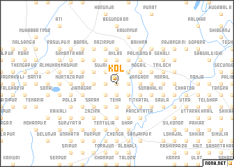
Kol (Barisāl, Bangladesh)Kol is a town in the Barisāl region of Bangladesh. An overview map of the region around Kol is displayed below.
regional and 3d topo map of Kol, Bangladesh ::
Kol airports ::
The nearest airport is RJH - Rajshahi Shah Mokhdum, located 79.5 km south west of Kol.
Other airports nearby include IRD - Ishurdi (89.1 km south), SPD - Saidpur (93.3 km north), COH - Cooch-behar Cooch Behar (155.9 km north), DAC - Dhaka Zia Intl (175.0 km south east), Nearby towns ::
Ālampur (0.0km north) //
Bānia Chāpar (1.7km east) //
Paulanj (1.7km west) //
Berunj (1.7km west) //
Gharam (1.9km south) //
Sarābdipur (1.9km south) //
Sībpur (1.9km north) //
Dokarikul (2.5km south east) //
Pothātti (2.5km south east) //
Dakshin Bāsta (2.5km north east) //
Māhmūdpur (2.5km south west) //
Dublāpāra (2.5km south west) //
Chāmrul (2.5km south west) //
Pāchul (2.5km north west) //
Gurura (2.5km north west) //
Sujāpur (2.5km north west) //
Khariza Deotāhār (2.5km north west) //
Suhli (2.5km north west) //
Tema (3.7km south) //
Bhāli (3.7km south) //
Mangait (3.7km south) //
Johāli (3.7km south) //
Masimpur (3.7km south) //
Mātāi (3.7km south) //
Mustafāpur (3.7km south) //
Āklās (3.7km north) //
Dakshin Maheshpur (3.7km north) //
Bhārāhār (3.4km east) //
Jāngaon (3.4km east) //
[all distances 'as the bird flies' and approximate] 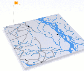 Places with similar names to Kol, Bangladesh ::
Disclaimer :: Information on this page comes without warranty of any kind |
||
|
Where is Kol? Elevation and coordinates ::
Latitude (lat): 24°57'0"N Longitude (lon): 89°10'0"E
Elevation (approx.): 24m (map arrows pan, magnifying glasses zoom) |
||
|
Visiting Kol? Hotel/Accommodation ::
Book a hotel in Kol Travel Guide ::
Buy a travel guide for Bangladesh rental cars ::
car rental offers GPS waypoint ::
download a GPX waypoint (PoI) of Kol for your GPS receiver
|
||