|
search place name
|
||
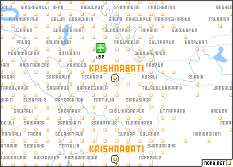
Krishnabāti (Barisāl, Bangladesh)Krishnabāti is a town in the Barisāl region of Bangladesh. An overview map of the region around Krishnabāti is displayed below.
regional and 3d topo map of Krishnabāti, Bangladesh ::
Krishnabāti airports ::
The nearest airport is JSR - Jessore, located 6.0 km north of Krishnabāti.
Other airports nearby include CCU - Calcutta Netaji Subhash Chandra Bose Intl (92.3 km south west), IRD - Ishurdi (113.7 km north), DAC - Dhaka Zia Intl (146.9 km north east), RJH - Rajshahi Shah Mokhdum (155.5 km north), Nearby towns ::
Media (0.0km north) //
Tapaswidānga (0.0km north) //
Māidia (1.9km south) //
Durgāpur (1.7km west) //
Mālanchi (1.7km west) //
Dhopākhola (1.7km west) //
Mandalgānti (1.9km north) //
Brahmottar Patingāli (1.9km north) //
Raghurāmpur (1.9km north) //
Bhāturia (1.7km east) //
Berbāri (1.7km east) //
Karicha (2.5km south west) //
Chhota Meghala (2.5km south west) //
Bhikutia (2.5km north west) //
Patingāli (2.5km north west) //
Kholādānga (2.5km north east) //
Tegharia (3.4km west) //
Bāje Durgāpur (3.4km west) //
Erenda (3.4km west) //
Rupdia (3.7km south) //
Sujalpur (3.7km north) //
Ārabpur (3.7km north) //
Chānchra (3.4km east) //
Mobārakkāti (3.4km east) //
Bara Meghala (3.9km south west) //
Tentulia (4.1km south west) //
Rudrapur (4.1km south west) //
Goāldaha (4.1km south west) //
Chāndpur Pākdia (3.9km north west) //
[all distances 'as the bird flies' and approximate] 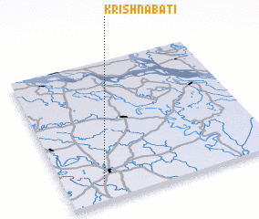 Places with similar names to Krishnabāti, Bangladesh ::
// Krishnabāti (BD)
// Krishnabāti (BD)
Disclaimer :: Information on this page comes without warranty of any kind |
||
|
Where is Krishnabāti? Elevation and coordinates ::
Latitude (lat): 23°8'0"N Longitude (lon): 89°11'0"E
Elevation (approx.): 12m (map arrows pan, magnifying glasses zoom) |
||
|
Visiting Krishnabāti? Hotel/Accommodation ::
Book a hotel in Krishnabāti Travel Guide ::
Buy a travel guide for Bangladesh rental cars ::
car rental offers GPS waypoint ::
download a GPX waypoint (PoI) of Krishnabāti for your GPS receiver
|
||