|
search place name
|
||
Kukhandi (Barisāl, Bangladesh)Kukhandi is a town in the Barisāl region of Bangladesh. An overview map of the region around Kukhandi is displayed below.
regional and 3d topo map of Kukhandi, Bangladesh ::

Kukhandi airports ::
The nearest airport is RJH - Rajshahi Shah Mokhdum, located 7.8 km north west of Kukhandi.
Other airports nearby include IRD - Ishurdi (46.5 km south east), JSR - Jessore (142.1 km south), SPD - Saidpur (154.4 km north), DAC - Dhaka Zia Intl (185.9 km east), Nearby towns ::
Kismat Kukhandi (0.0km north) //
Mohanpur (1.9km south) //
Hāzrāpukur (1.9km south) //
Māskātādīghi (1.9km south) //
Hariān (1.7km east) //
Kāliārpāra (1.7km east) //
Meherchandi (1.7km west) //
Bāmansikhar (1.9km north) //
Mallikpur (1.9km north) //
Rupsidānga (2.5km south east) //
Emādpur (2.5km south east) //
Samsādipur (2.5km south east) //
Budhpāra (2.5km south west) //
Keoāgāchhi (2.5km south west) //
Dharampur (2.5km south west) //
Mirzāpur (2.5km south west) //
Ranhāt (2.5km north east) //
Kālumer (2.5km north west) //
Purāpukur (2.5km north west) //
Syāmpur (3.7km south) //
Bākrābād (3.7km south) //
Jāgīr (3.4km east) //
Sucharan (3.4km east) //
Jāmālpur (3.4km west) //
Pānthāpāra (3.7km north) //
Rāmchandrapur (3.7km north) //
Chāmpāpukur (3.7km north) //
Bālānagar (3.7km north) //
Kaipukuria (3.7km north) //
[all distances 'as the bird flies' and approximate] 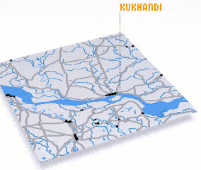 Places with similar names to Kukhandi, Bangladesh ::
// Cocohondo (CO)
// Guaicohondo (CO)
Disclaimer :: Information on this page comes without warranty of any kind |
||
|
Where is Kukhandi? Elevation and coordinates ::
Latitude (lat): 24°23'0"N Longitude (lon): 88°40'0"E
Elevation (approx.): 20m (map arrows pan, magnifying glasses zoom) |
||
|
Visiting Kukhandi? Hotel/Accommodation ::
Book a hotel in Kukhandi Travel Guide ::
Buy a travel guide for Bangladesh rental cars ::
car rental offers GPS waypoint ::
download a GPX waypoint (PoI) of Kukhandi for your GPS receiver
|
||