|
search place name
|
||
Latifpur (Barisāl, Bangladesh)Latifpur is a town in the Barisāl region of Bangladesh. An overview map of the region around Latifpur is displayed below.
regional and 3d topo map of Latifpur, Bangladesh ::

Latifpur airports ::
The nearest airport is DAC - Dhaka Zia Intl, located 40.8 km south east of Latifpur.
Other airports nearby include IRD - Ishurdi (111.9 km west), IXA - Agartala (114.3 km east), JSR - Jessore (145.7 km south west), RJH - Rajshahi Shah Mokhdum (159.3 km west), Nearby towns ::
Pānchgaon (2.5km north east) //
Beltail (3.4km east) //
Pāgāria (3.4km east) //
Gopālsen (3.7km south) //
Baradām (3.4km west) //
North Dhuāsār (3.9km south east) //
Gorāi (4.1km south east) //
Tarappur (3.9km north west) //
Bāstail (4.1km north east) //
Dauhātali (4.1km north west) //
Gorāki (5.4km west) //
Chiteswari (5.4km east) //
Mir Deohāta (5.8km south) //
Gājeswari (5.8km north) //
Āgjāna (6.3km south east) //
Chāpāir (6.5km south east) //
Mirzāpur (6.3km south west) //
Bāor Kumārjāni (6.3km south west) //
Gāera Betil (6.3km north east) //
Bahuria (7.6km south) //
Pekua (7.6km north) //
Thalpāra (7.0km west) //
Kāthālia (7.5km south east) //
Bhāora (7.5km south west) //
Jautuki (7.5km north west) //
Bhāumān (8.1km south east) //
Pārdighi (7.7km north west) //
Srifaltali (9.0km south east) //
Saidāmpur (9.0km north west) //
[all distances 'as the bird flies' and approximate] 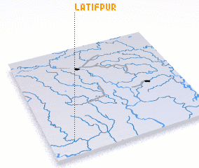 Places with similar names to Latifpur, Bangladesh ::
Disclaimer :: Information on this page comes without warranty of any kind |
||
|
Where is Latifpur? Elevation and coordinates ::
Latitude (lat): 24°8'0"N Longitude (lon): 90°9'0"E
Elevation (approx.): 10m (map arrows pan, magnifying glasses zoom) |
||
|
Visiting Latifpur? Hotel/Accommodation ::
Book a hotel in Latifpur Travel Guide ::
Buy a travel guide for Bangladesh rental cars ::
car rental offers GPS waypoint ::
download a GPX waypoint (PoI) of Latifpur for your GPS receiver
|
||