|
search place name
|
||
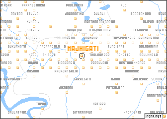
Mājhigāti (Barisāl, Bangladesh)Mājhigāti is a town in the Barisāl region of Bangladesh. An overview map of the region around Mājhigāti is displayed below.
regional and 3d topo map of Mājhigāti, Bangladesh ::
Mājhigāti airports ::
The nearest airport is JSR - Jessore, located 71.1 km west of Mājhigāti.
Other airports nearby include DAC - Dhaka Zia Intl (84.9 km north east), IRD - Ishurdi (127.6 km north west), IXA - Agartala (157.7 km north east), CCU - Calcutta Netaji Subhash Chandra Bose Intl (159.1 km south west), Nearby towns ::
Sultān Dighirpār (0.0km north) //
Arjundaha (0.0km north) //
Māchhiāra (0.0km north) //
Dhākpāra (1.9km north) //
Naya Pushkarinirpār (1.9km north) //
Fulhāra (1.9km north) //
Latifpur (1.9km north) //
Gobindapur (1.7km west) //
Pānchra (1.9km south) //
Chhota Bhatra (1.9km south) //
Khāndārpār (1.7km east) //
Jhākar (1.7km east) //
Kendua (1.7km east) //
Induhāti (1.7km east) //
North Dhirāil (1.7km east) //
Durgāpur (2.5km north west) //
Srinibāskāti (2.5km north west) //
Guptagāti (2.5km north east) //
Pāthrāil (2.5km north east) //
Sāsunia (2.5km north east) //
Gopālpur (2.5km north east) //
Pālpāra (2.5km south west) //
Bahugrām (2.5km south east) //
Dharenda (2.5km south east) //
Dublasur (2.5km south east) //
Māthābhānga Gopālpur (2.5km south east) //
Dahar Durgāpur (3.4km west) //
Muksūdpur (3.7km north) //
Kadampur (3.7km north) //
[all distances 'as the bird flies' and approximate] 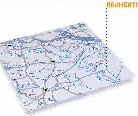 Places with similar names to Mājhigāti, Bangladesh ::
// Mājhigāti (BD)
Disclaimer :: Information on this page comes without warranty of any kind |
||
|
Where is Mājhigāti? Elevation and coordinates ::
Latitude (lat): 23°16'0"N Longitude (lon): 89°51'0"E
Elevation (approx.): 6m (map arrows pan, magnifying glasses zoom) |
||
|
Visiting Mājhigāti? Hotel/Accommodation ::
Book a hotel in Mājhigāti Travel Guide ::
Buy a travel guide for Bangladesh rental cars ::
car rental offers GPS waypoint ::
download a GPX waypoint (PoI) of Mājhigāti for your GPS receiver
|
||