|
search place name
|
||
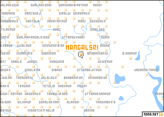
Mangalsri (Barisāl, Bangladesh)Mangalsri is a town in the Barisāl region of Bangladesh. An overview map of the region around Mangalsri is displayed below.
regional and 3d topo map of Mangalsri, Bangladesh ::
Mangalsri airports ::
The nearest airport is ZYL - Sylhet Osmani Osmany Intl, located 96.1 km east of Mangalsri.
Other airports nearby include IXA - Agartala (98.3 km south), DAC - Dhaka Zia Intl (113.4 km south west), IXH - Kailashahar (117.0 km south east), IRD - Ishurdi (203.2 km west), Nearby towns ::
Bārai Bhādera (1.9km south) //
Dakshin Sukhāri (1.9km north) //
Bāhādurpur (1.9km north) //
Nilkanthapur (1.9km north) //
Paschim Tārāchāpuri (1.7km east) //
Debsri (1.7km west) //
Hātia (1.7km east) //
Jahāngīrpur (2.5km south west) //
Imdādpur (2.5km south east) //
Khālapāra (2.5km north east) //
Bhabānīpur Debdwār (2.5km north east) //
Narapatikhila (2.5km north west) //
Bri Barikāndi (3.4km east) //
Kuliāti (3.8km south east) //
Hānskuri Maidhām (3.8km south west) //
Hāzrāgāti (3.8km south west) //
Swalpa Bāusha (3.8km north east) //
Nij Tārāchāpuri (3.8km north east) //
Uttar Bājitpur (4.1km south east) //
Kāpāsātia (4.1km south east) //
Chāndgaon (4.1km south west) //
Ākhāsri (4.1km south east) //
Gopālāsram Madhuākhāli (3.8km north west) //
Uttar Sukhāri (4.1km north west) //
Kāhetura (4.1km north east) //
Bāusha (4.1km north east) //
Sonājor (4.1km north west) //
Rāmkrishnapur (5.0km north west) //
Maheswarkhila (5.0km north west) //
[all distances 'as the bird flies' and approximate] 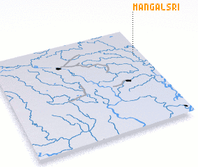 Places with similar names to Mangalsri, Bangladesh ::
// Miān Gulzara (PK)
Disclaimer :: Information on this page comes without warranty of any kind |
||
|
Where is Mangalsri? Elevation and coordinates ::
Latitude (lat): 24°44'0"N Longitude (lon): 90°57'0"E
Elevation (approx.): 9m (map arrows pan, magnifying glasses zoom) |
||
|
Visiting Mangalsri? Hotel/Accommodation ::
Book a hotel in Mangalsri Travel Guide ::
Buy a travel guide for Bangladesh rental cars ::
car rental offers GPS waypoint ::
download a GPX waypoint (PoI) of Mangalsri for your GPS receiver
|
||