|
search place name
|
||
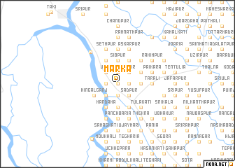
Mārka (Barisāl, Bangladesh)Mārka is a town in the Barisāl region of Bangladesh. An overview map of the region around Mārka is displayed below.
regional and 3d topo map of Mārka, Bangladesh ::
Mārka airports ::
The nearest airport is CCU - Calcutta Netaji Subhash Chandra Bose Intl, located 61.6 km west of Mārka.
Other airports nearby include JSR - Jessore (79.0 km north), IRD - Ishurdi (184.9 km north), DAC - Dhaka Zia Intl (206.6 km north east), RJH - Rajshahi Shah Mokhdum (220.2 km north), Nearby towns ::
Kukhādānga (0.0km north) //
Sultānpur (0.0km north) //
Swarāpdipur (0.0km north) //
Bhārāsimla (1.7km east) //
Khāmārpāra (1.9km south) //
Kāmdebpur (1.9km south) //
Chāltābāria (1.9km north) //
Hijli Chandipur (1.9km north) //
Uttar Kāsimpur (1.9km north) //
Māgri (1.9km north) //
Dādpur (1.7km west) //
Chāndkāti (1.7km west) //
Kānksiāli (2.5km south east) //
Sādpur (2.5km south east) //
Mamrejpur (2.5km south east) //
Nārāyanpur (2.5km south east) //
Amiān (2.5km south east) //
Nalta (2.5km north east) //
Ghona (2.5km north east) //
Basantapur (2.5km south west) //
Khārhāt (2.5km south west) //
Chak Gobinda (2.5km south west) //
Bāgbāti (2.5km north west) //
Bāthuādānga (3.4km east) //
Sitalpur Bara (3.7km south) //
Sibpur (3.7km north) //
Māgurāli (3.7km north) //
Kāsimpur (4.1km south east) //
Bāzārgrām (4.1km south east) //
[all distances 'as the bird flies' and approximate] 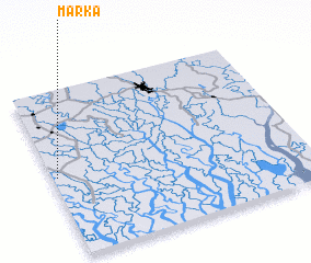 Places with similar names to Mārka, Bangladesh ::
Disclaimer :: Information on this page comes without warranty of any kind |
||
|
Where is Mārka? Elevation and coordinates ::
Latitude (lat): 22°29'0"N Longitude (lon): 89°1'0"E
Elevation (approx.): 3m (map arrows pan, magnifying glasses zoom) |
||
|
Visiting Mārka? Hotel/Accommodation ::
Book a hotel in Mārka Travel Guide ::
Buy a travel guide for Bangladesh rental cars ::
car rental offers GPS waypoint ::
download a GPX waypoint (PoI) of Mārka for your GPS receiver
|
||