|
search place name
|
||
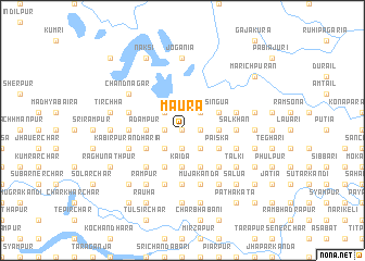
Māura (Barisāl, Bangladesh)Māura is a town in the Barisāl region of Bangladesh. An overview map of the region around Māura is displayed below.
regional and 3d topo map of Māura, Bangladesh ::
Māura airports ::
The nearest airport is DAC - Dhaka Zia Intl, located 128.4 km south of Māura.
Other airports nearby include IRD - Ishurdi (145.9 km south west), SPD - Saidpur (153.0 km north west), IXA - Agartala (163.1 km south east), COH - Cooch-behar Cooch Behar (164.9 km north west), Nearby towns ::
Nakla (0.0km north) //
Char Kaia (1.9km south) //
Māminākānda (1.9km south) //
Ferusa (1.7km east) //
Garergaon (1.7km east) //
Dhukuria (1.7km east) //
Gajāria (1.7km west) //
Bāraikāndi (1.7km west) //
Isibpur (2.5km south east) //
Bāzārdi (2.5km south east) //
Jālālpur (2.5km south west) //
Chhatarkona (2.5km north east) //
Khārjān (2.5km north west) //
Kāida (3.7km south) //
Bāliādi (3.7km south) //
Rihila (3.4km east) //
Ganapaddi (3.4km west) //
Ādampur (3.4km west) //
Bishnupur (4.1km south east) //
Kursābādāgair (3.8km south east) //
Pāiska (3.8km south east) //
Bāneswardi (4.1km south west) //
Singua (3.8km north east) //
Dhāmna (3.8km north east) //
Bhurdi (3.8km south west) //
Pipri (5.0km south east) //
Kalāpāra (5.0km south east) //
Bāusa (5.0km south west) //
Ālināpāra (5.0km west) //
[all distances 'as the bird flies' and approximate] 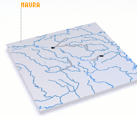 Places with similar names to Māura, Bangladesh ::
Disclaimer :: Information on this page comes without warranty of any kind |
||
|
Where is Māura? Elevation and coordinates ::
Latitude (lat): 24°59'0"N Longitude (lon): 90°10'0"E
Elevation (approx.): 20m (map arrows pan, magnifying glasses zoom) |
||
|
Visiting Māura? Hotel/Accommodation ::
Book a hotel in Māura Travel Guide ::
Buy a travel guide for Bangladesh rental cars ::
car rental offers GPS waypoint ::
download a GPX waypoint (PoI) of Māura for your GPS receiver
|
||