|
search place name
|
||
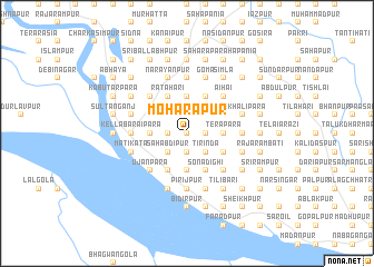
Moharāpur (Barisāl, Bangladesh)Moharāpur is a town in the Barisāl region of Bangladesh. An overview map of the region around Moharāpur is displayed below.
regional and 3d topo map of Moharāpur, Bangladesh ::
Moharāpur airports ::
The nearest airport is RJH - Rajshahi Shah Mokhdum, located 23.9 km east of Moharāpur.
Other airports nearby include IRD - Ishurdi (76.0 km south east), SPD - Saidpur (152.7 km north), JSR - Jessore (162.7 km south east), CCU - Calcutta Netaji Subhash Chandra Bose Intl (200.8 km south), Nearby towns ::
Champaknagar (0.0km north) //
Tulsipur (0.0km north) //
Tājindarpur (0.0km north) //
Tājanpur (0.0km north) //
Sāylā (1.9km north) //
Sāguān (1.7km west) //
Pasunda (1.7km west) //
Kānāidānga (1.7km west) //
Bhajanpur (1.9km south) //
Bāje Tirinda (1.9km south) //
Mollāpāra (1.7km east) //
Murāripur (1.7km east) //
Hābaspur (1.9km south) //
Madusaila (2.5km north west) //
Khudra Sāola (2.5km north west) //
Madhya Sāola (2.5km north west) //
Jalāhāri (2.5km north west) //
Jadubhāskarpur (2.5km north west) //
Pohāpur (2.5km north east) //
Sāhabdipur (2.5km south west) //
Dādh Jhikra (2.5km south west) //
Rasūlpur (2.5km south west) //
Tirinda (2.5km south east) //
Jote Parasurām (2.5km south east) //
Māchhmāra (2.5km south east) //
Sābāipur (2.5km south east) //
Bejra (3.7km north) //
Mādhāipur (3.7km north) //
Durgāpur (3.4km west) //
[all distances 'as the bird flies' and approximate] 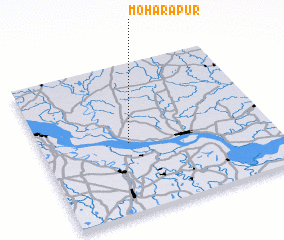 Places with similar names to Moharāpur, Bangladesh ::
Disclaimer :: Information on this page comes without warranty of any kind |
||
|
Where is Moharāpur? Elevation and coordinates ::
Latitude (lat): 24°28'0"N Longitude (lon): 88°23'0"E
Elevation (approx.): 37m (map arrows pan, magnifying glasses zoom) |
||
|
Visiting Moharāpur? Hotel/Accommodation ::
Book a hotel in Moharāpur Travel Guide ::
Buy a travel guide for Bangladesh rental cars ::
car rental offers GPS waypoint ::
download a GPX waypoint (PoI) of Moharāpur for your GPS receiver
|
||