|
search place name
|
||
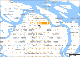
Mohish Khola (Barisāl, Bangladesh)Mohish Khola is a town in the Barisāl region of Bangladesh. An overview map of the region around Mohish Khola is displayed below.
regional and 3d topo map of Mohish Khola, Bangladesh ::
Mohish Khola airports ::
The nearest airport is DAC - Dhaka Zia Intl, located 60.3 km north of Mohish Khola.
Other airports nearby include IXA - Agartala (110.4 km north east), JSR - Jessore (124.1 km west), IRD - Ishurdi (164.2 km north west), CGP - Chittagong Shah Amanat Intl (188.7 km south east), Nearby towns ::
Narikelta (1.9km north) //
Harendranagar (1.7km west) //
Nayan Mātbarerkāndi (1.9km south) //
Char Kāndapāra (1.9km south) //
Bilāspur (2.5km north east) //
Kākrābhog (2.5km north east) //
Japsa (2.5km south east) //
Punaikhar Kandi (2.5km north west) //
Cherāgāli Bepārir Kāndi (2.5km north west) //
Jān Khāner Kāndi (2.5km north west) //
Mālāi Mridhār Kāndi (2.5km north west) //
Udaytāra (2.5km south west) //
Khilgaon (2.5km south west) //
Mirpur (2.5km south west) //
Dagri (2.5km south west) //
Mulāi Bepārir Kāndi (3.7km north) //
Miāchān Munsir Kāndi (3.7km north) //
Dāimaddin Khalifār Kāndi (3.7km north) //
Bhojeswar (3.7km south) //
Ekāndal (3.7km south) //
Rājnagar (3.4km west) //
Kāziār Char (4.1km north east) //
Bhānu Mālliker Kāndi (4.1km north east) //
Hāldār Kāndi (4.1km north west) //
Meherāli Munsir Kāndi (4.1km north west) //
Fakirmāmud Akaner Kāndi (4.1km north west) //
Kabiraj Kāndi (4.1km north west) //
Budhāi Mātbarer Kāndi (4.1km north west) //
Jabberāli Akaner Kāndi (4.1km north west) //
[all distances 'as the bird flies' and approximate]  Places with similar names to Mohish Khola, Bangladesh ::
// Mahishākhola (BD)
// Mahishkhola (BD)
// Mahishkhola (BD)
// Mahishkhola (BD)
// Maheshkhāli (BD)
Disclaimer :: Information on this page comes without warranty of any kind |
||
|
Where is Mohish Khola? Elevation and coordinates ::
Latitude (lat): 23°18'0"N Longitude (lon): 90°22'0"E
Elevation (approx.): 7m (map arrows pan, magnifying glasses zoom) |
||
|
Visiting Mohish Khola? Hotel/Accommodation ::
Book a hotel in Mohish Khola Travel Guide ::
Buy a travel guide for Bangladesh rental cars ::
car rental offers GPS waypoint ::
download a GPX waypoint (PoI) of Mohish Khola for your GPS receiver
|
||